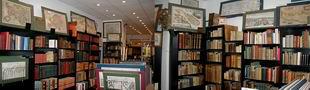
The oldest virtual antiquarium in Hungary.
Sós Antikvárium
Designed and made byte261. map/Israel, Palestine, Judaica put into the basket Homann (Heirs) /Harenberg/: PALAESTINA in XII. TRIBUS divisa, CUM TERRIS ADIACENTIBUS denuo revisa & copiosior reddita.Nürnberg. 1750. hand colored copper engraving.size: 44x51 cm. page: 55x62 cm. intact margin. price: 340.91 EURO | 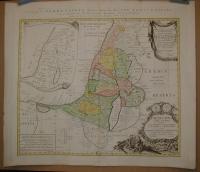 |
te283. map/France put into the basket Merian, Matthäus: Lotharingia ducatus; Vúlgo Lorraine.Frankfurt. 1695. copper engraving.size: 28x36 cm. page: 32x37 cm. price: 79.55 EURO |  |
te284. map/France put into the basket Merian, Matthäus: Sabaudia Ducatus Savoye.Frankfurt. 1695. copper engraving.size: 27x36 cm. page: 32x37 cm. stained. price: 79.55 EURO | 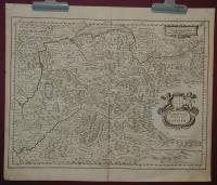 |
te285. map/France put into the basket Merian, Matthäus: Utriusque Burgundiae, tum Ducatus tum Comitatus Descriptio.Frankfurt. 1695. copper engraving.size: 27x36 cm. page: 32x37 cm. stained. price: 79.55 EURO | 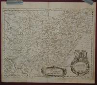 |
te1543. map/Hungarian city map, tourist put into the basket SOPRON és környéke. 1.75000.Bp. ca. 1930. .size: 19x26 cm. page: 21x29 cm. price: 4.26 EURO | 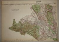 |
te1006. map/Hungarian county map put into the basket Gönczy Pál: Csanád vármegye térképe.Budapest. 1894. .size: 24x30 cm. price: 3.41 EUROGönczy Pál (Hajdúszoboszló, 1817. dec. 26. – Karácsond, 1892. jan. 10.):
pedagógus, az MTA l. tagja (1858). 1834-től a debreceni kollégiumban bölcsészetet tanult, 1838-tól tanító, ill.... | 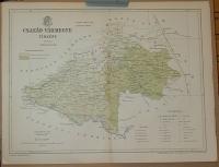 |
te1530. map/Africa put into the basket Mollo, Tranquillo (kiadó): AFRICA.Wien. 1817. border colored copper engraving.size: 32x44 cm. page: 37x48 cm. stained outside the picture. price: 127.84 EUROMegjelent: Lehrbuch der Geographie, zeigt das Kaisertum Österreich nach dem Wiener Kongress. | 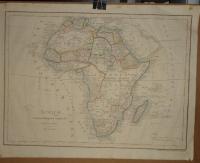 |
te1116. map/Hungary put into the basket Merian, Matthäus: Hungaria Regnum.Frankfurt. 1638. copper engraving.size: 26x31 cm. page: 31x37 cm. in green paspartu. price: 198.86 EURO |  |
te1522. map/Asia put into the basket Mollo, Tranquillo (kiadó): Persien und Arabien.Wien. 1817. border colored copper engraving.size: 31x43 cm. page: 37x48 cm. stained outside the picture. price: 142.05 EUROMegjelent: Lehrbuch der Geographie, zeigt das Kaisertum Österreich nach dem Wiener Kongress. | 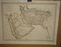 |
te968. map/Hungarian county map put into the basket Gönczy Pál: Kis-Küküllő vármegye térképe.Budapest. 1894. .size: 24x30 cm. price: 3.41 EUROGönczy Pál (Hajdúszoboszló, 1817. dec. 26. – Karácsond, 1892. jan. 10.):
pedagógus, az MTA l. tagja (1858). 1834-től a debreceni kollégiumban bölcsészetet tanult, 1838-tól tanító, ill... |  |
te989. map/Hungarian county map put into the basket Gönczy Pál: Szolnok-Doboka vármegye térképe.Budapest. 1894. .size: 24x30 cm. price: 3.41 EUROGönczy Pál (Hajdúszoboszló, 1817. dec. 26. – Karácsond, 1892. jan. 10.):
pedagógus, az MTA l. tagja (1858). 1834-től a debreceni kollégiumban bölcsészetet tanult, 1838-tól tanító, ill.... |  |
te495. map/Hungarian county map put into the basket Gönczy Pál: Nagy-Küküllő vármegye térképe.Budapest. ca 1900. .size: 20x26 cm. page: 24x30 cm. price: 5.11 EURO |  |
te973. map/Hungarian county map put into the basket Gönczy Pál: Beszterce-Naszód vármegye térképe.Budapest. 1894. .size: 24x30 cm. price: 3.41 EUROGönczy Pál (Hajdúszoboszló, 1817. dec. 26. – Karácsond, 1892. jan. 10.):
pedagógus, az MTA l. tagja (1858). 1834-től a debreceni kollégiumban bölcsészetet tanult, 1838-tól tanító, ill.... |  |
te514. map/Hungarian county map put into the basket Gönczy Pál: Szeben vármegye térképe.Budapest. ca 1900. .size: 20x27 cm. page: 24x30 cm. price: 3.41 EURO |  |
te1007. map/Hungarian county map put into the basket Gönczy Pál: Torontál vármegye térképe.Budapest. 1894. .size: 30x24 cm. price: 4.26 EUROGönczy Pál (Hajdúszoboszló, 1817. dec. 26. – Karácsond, 1892. jan. 10.):
pedagógus, az MTA l. tagja (1858). 1834-től a debreceni kollégiumban bölcsészetet tanult, 1838-tól tanító, ill.... | 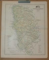 |
te977. map/Hungarian county map put into the basket Gönczy Pál: Arad vármegye térképe.Budapest. 1894. .size: 24x30 cm. price: 4.26 EUROGönczy Pál (Hajdúszoboszló, 1817. dec. 26. – Karácsond, 1892. jan. 10.):
pedagógus, az MTA l. tagja (1858). 1834-től a debreceni kollégiumban bölcsészetet tanult, 1838-tól tanító, ill.... | 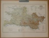 |
te1219. map/Canada put into the basket Bonne, Rigobert: Isle et Banc de Terre-Neuve, Isle Royale et Isle St. Jean; avec l'Acadie ou la Nouvelle Ecosse.Paris. ca. 1780. copper engraving.size: 22x33 cm. page: 31x44 cm. price: 102.27 EURO | 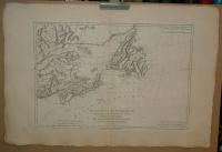 |
te1482. map/Hungarian county map put into the basket Gönczy Pál: Belovár-Kőrös megye.Budapest. 1885. .size: 35x44 cm. page: 44x57 cm. price: 17.05 EURO | 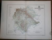 |
te1481. map/Hungarian county map put into the basket Gönczy Pál: Modrus-Fiume megye.Budapest. 1885. .size: 35x44 cm. page: 44x57 cm. price: 17.05 EURO |  |
te1473. map/Hungarian county map put into the basket Gönczy Pál: Sáros megye.Budapest. 1885. .size: 35x44 cm. page: 44x57 cm. price: 17.05 EURO |  |
te70. map/Hungarian county map put into the basket Gönczy Pál: Alsó-Fehér megye térképe.Budapest. 1888. .size: 31x42 cm. page: 44x57 cm. intact margin. price: 17.05 EURO |  |
te59. map/Hungarian county map put into the basket Gönczy Pál: Szerém megye térképe.Budapest. 1890. .size: 30x48 cm. page: 44x57 cm. intact margin. price: 17.05 EURO |  |
te54. map/Hungarian county map put into the basket Gönczy Pál: Lika-Krbava megye térképe.Budapest. 1890. .size: 33x42 cm. page: 44x57 cm. intact margin. price: 17.05 EURO |  |
te53. map/Hungarian county map put into the basket Gönczy Pál: Zágráb megye térképe.Budapest. 1890. .size: 34x43 cm. page: 44x57 cm. intact margin. price: 17.05 EURO |  |
te52. map/Hungarian county map put into the basket Gönczy Pál: Pozsega megye térképe.Budapest. 1890. .size: 32x51 cm. page: 44x57 cm. intact margin. price: 17.05 EURO |  |
te48. map/Hungarian county map put into the basket Gönczy Pál: Varasd megye térképe.Budapest. 1890. .size: 31x45 cm. page: 44x57 cm. intact margin. price: 17.05 EURO |  |
te46. map/Hungarian county map put into the basket Gönczy Pál: Bars megye térképe.Budapest. 1888. .size: 45x32 cm. page: 56x44 cm. intact margin. price: 17.05 EURO | 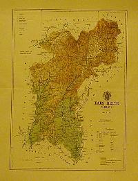 |
te1456. map/United Kingdom put into the basket Seutter, Matthaus: Tabula Novissima Accuratissima Regnorum Angliae, Scotiae, Hiberniae.Augsburg. ca.1725. hand colored copper engraving.size: 57x48 cm. page: 62x54 cm. price: 340.91 EURO | 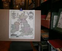 |
te250. map/United Kingdom put into the basket Homann, Johann Baptist: Magnae Britanniae Pars Meridionale, in qua Regnum Angliae.Nürnberg. ca. 1720. hand colored copper engraving.size: 56x48 cm. page: 61x53 cm. intact margin. price: 255.68 EUROIn the English Channel is an engraved vignette of Queen Anne in the House of Lords. | 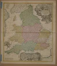 |
te1523. map/Asia put into the basket Mollo, Tranquillo (kiadó): Charte von Ost-Indien.Wien. 1817. border colored copper engraving.size: 31x43 cm. page: 37x48 cm. stained outside the picture. price: 113.64 EUROMegjelent: Lehrbuch der Geographie, zeigt das Kaisertum Österreich nach dem Wiener Kongress. | 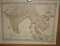 |
te1444. map/Asia put into the basket Bonne: L'Asie.Paris. 1780. copper engraving.size: 21x30 cm. page: 26x39 cm. price: 68.18 EURO | 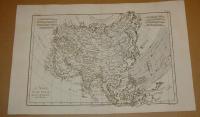 |
te1315. map/ put into the basket Neuester Plan von Ofen und Pesth in acht Farben gedruckt. Mit Angabe der Strassen und Gassen Namen.Pesth. 1849. lithography.size: 16x10 cm. price: 1278.41 EUROPlan von Ofen und Pest.34x52 cm, 42x60 cm
Plan oder Umgebungen von Ofen und Pest. 34x52 cm, 44x60 cm Walzel kőnyomatos térképe, körülötte Fuchsthaller 13 acélmetszetével Fabó-Holló/14... | 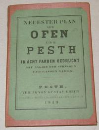 |
te1000. map/Hungarian county map put into the basket Gönczy Pál: Veszprém vármegye térképe, Balaton.Budapest. 1894. .size: 24x30 cm. price: 7.1 EUROGönczy Pál (Hajdúszoboszló, 1817. dec. 26. – Karácsond, 1892. jan. 10.):
pedagógus, az MTA l. tagja (1858). 1834-től a debreceni kollégiumban bölcsészetet tanult, 1838-tól tanító, ill.... | 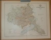 |
te1020. map/Hungarian county map put into the basket Gönczy Pál: Jász-Kun-Szolnok vármegye térképe.Budapest. 1894. .size: 30x24 cm. price: 3.41 EUROGönczy Pál (Hajdúszoboszló, 1817. dec. 26. – Karácsond, 1892. jan. 10.):
pedagógus, az MTA l. tagja (1858). 1834-től a debreceni kollégiumban bölcsészetet tanult, 1838-tól tanító, ill.... | 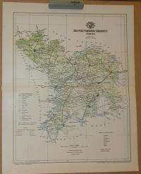 |
te1027. map/Hungarian county map put into the basket Gönczy Pál: Szepes vármegye térképe.Budapest. 1894. .size: 30x24 cm. price: 3.41 EUROGönczy Pál (Hajdúszoboszló, 1817. dec. 26. – Karácsond, 1892. jan. 10.):
pedagógus, az MTA l. tagja (1858). 1834-től a debreceni kollégiumban bölcsészetet tanult, 1838-tól tanító, ill.... |  |
te987. map/Hungarian county map put into the basket Gönczy Pál: Szerém vármegye térképe.Budapest. 1894. .size: 24x30 cm. price: 3.41 EUROGönczy Pál (Hajdúszoboszló, 1817. dec. 26. – Karácsond, 1892. jan. 10.):
pedagógus, az MTA l. tagja (1858). 1834-től a debreceni kollégiumban bölcsészetet tanult, 1838-tól tanító, ill.... |  |
te967. map/Hungarian county map put into the basket Gönczy Pál: Vas vármegye.Budapest. 1894. .size: 24x30 cm. price: 3.41 EUROGönczy Pál (Hajdúszoboszló, 1817. dec. 26. – Karácsond, 1892. jan. 10.):
pedagógus, az MTA l. tagja (1858). 1834-től a debreceni kollégiumban bölcsészetet tanult, 1838-tól tanító, ill... |  |
te485. map/Hungarian county map put into the basket Gönczy Pál: Belovár-Körös vármegye térképe.Budapest. ca 1900. .size: 21x28 cm. page: 24x30 cm. price: 3.41 EURO |  |
te416. map/Hungarian county map put into the basket Gönczy Pál: Győr vármegye térképe.Budapest. 1894. .size: 25x19 cm. page: 330x24 cm. intact margin. price: 3.41 EURO |  |
te943. map/Israel, Palestine, Judaica put into the basket Jansonii, Ioannis (1588-1664) (Janssonius): SITUS TERRAE PROMISSIONIS S.S. Bibliorum intelligentiam exacte aperiens per Chr. Adrichom.Amsterdam. um. 1650. copper engraving.size: 34x48 cm. page: 48x56 cm. clean, sharp issue. minimal implosion on the margin. price: 312.5 EURO | 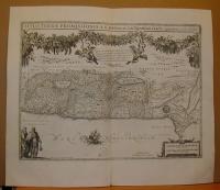 |
te849. map/Germany put into the basket Brion De La Tour, Louis:: L'Alemagne Divisee En Tous Se Cercles.Paris. 1766. border colored copper engraving.size: 22x25 cm. page: 29x38 cm. in green paspartu. intact margin. price: 113.64 EURO | 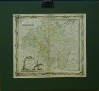 |
te527. map/France put into the basket Sanson, Nicolas: La Franche Comte divisee en Trois Grands Balliages scavoir d' Amont, d' Aval, et du Milieu ou de Dole.Paris. 1692. border colored copper engraving.size: 77x53 cm. page: 95x64 cm. intact margin. price: 113.64 EURO | 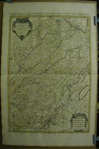 |
te528. map/France put into the basket Sanson, Nicolas: Gouvernement D'Orleans Et La Generalite.Paris. 1693. border colored copper engraving.size: 47x67 cm. page: 64x98 cm. intact margin. price: 113.64 EURO | 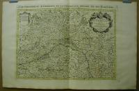 |
te526. map/France put into the basket Sanson, Nicolas: LeGouvernement General Du Dauphiné.Paris. 1692. border colored copper engraving.size: 52x83 cm. page: 64x98 cm. stained. price: 113.64 EURO | 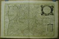 |
te525. map/Germany put into the basket Sanson, Nicolas: Basse Partie De L'Evesché De Munster Et Le Comté De Benthem.Paris. 1692. border colored copper engraving.size: 42x54 cm. page: 51x64 cm. intact margin. price: 102.27 EURO | 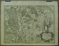 |
te524. map/Germany put into the basket Sanson, Nicolas: Haute Partie De L'Eveschéde Munster.Paris. 1692. border colored copper engraving.size: 41x54 cm. page: 51x64 cm. intact margin. price: 102.27 EURO |  |
te523. map/Germany put into the basket Sanson, Nicolas: Partie Orientale Du Temporel De L'Archevesché Et Eslectorat De Treves.Paris. 1692. border colored copper engraving.size: 41x54 cm. page: 50x64 cm. intact margin. price: 102.27 EURO | 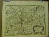 |
te522. map/Germany put into the basket Sanson, Nicolas: Partie Occidentale Du Palatinat Et Eslectorat Du Rhein Le Duché De Simmeren, Les Comtés De Spanheim Et de Veldentz A La Maison Palatine.Paris. 1692. border colored copper engraving.size: 42x53 cm. page: 50x64 cm. minimaly stained outside the picture. price: 102.27 EURO | 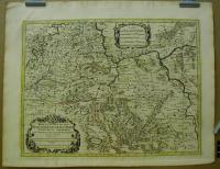 |
te1145. map/Serb, Croatian, Slovenian put into the basket Seutter, Matthäus: EXACTISSIMA DUCATUS CARNIOLAE VINIDORUM MARCHIÄ ET HISTRIAE DELINEATIO.Augsburg. ca. 1730. hand colored copper engraving.size: 47x55 cm. page: 54x62 cm. in green paspartu. stained outside the picture. price: 340.91 EURO | 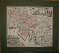 |
te1004. map/Hungarian county map put into the basket Gönczy Pál: Pozsega vármegye térképe. Požega, Požeška županija.Budapest. 1894. .size: 24x30 cm. price: 4.26 EUROCroatia,
Gönczy Pál (Hajdúszoboszló, 1817. dec. 26. – Karácsond, 1892. jan. 10.): pedagógus, az MTA l. tagja (1858). 1834-től a debreceni kollégiumban bölcsészetet tanult, 1838-tól tan... |  |
