The oldest virtual antiquarium in Hungary.

Sós Antikvárium
Designed and made byte957. map/Asia put into the basket Robert De Vaugondy: Carte de l'Asie dressée sur les relations les plus nouvelles principalement sur les cartes de Russie, de la Chine.Paris. 1751. border colored copper engraving.size: 45x50 cm. page: 55x78 cm. clean, sharp issue. price: 255.68 EURO | 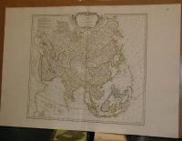 |
te1148. map/Asia put into the basket Mayer-Homann Heirs: Carte des Indes Orientales dessinée suivant les observations les plus recentes, dont le principal est tirée des cartes hydrographiques de Mr. D'Apres de Mannevillette.Nürnberg. 1748. hand colored copper engraving.size: 48x83 cm. page: 54x93 cm. stained. folded. price: 426.14 EURO | 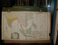 |
te1206. map/Asia put into the basket Bonne, Rigobert: Terre De Kerguelen, Appellee par M. Cook, Isle De La Desolation.Paris. ca.1780. copper engraving.size: 22x33 cm. page: 32x46 cm. price: 34.09 EURO | 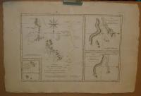 |
te1444. map/Asia put into the basket Bonne: L'Asie.Paris. 1780. copper engraving.size: 21x30 cm. page: 26x39 cm. price: 68.18 EURO | 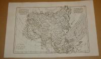 |
te1522. map/Asia put into the basket Mollo, Tranquillo (kiadó): Persien und Arabien.Wien. 1817. border colored copper engraving.size: 31x43 cm. page: 37x48 cm. stained outside the picture. price: 142.05 EUROMegjelent: Lehrbuch der Geographie, zeigt das Kaisertum Österreich nach dem Wiener Kongress. | 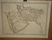 |
te1523. map/Asia put into the basket Mollo, Tranquillo (kiadó): Charte von Ost-Indien.Wien. 1817. border colored copper engraving.size: 31x43 cm. page: 37x48 cm. stained outside the picture. price: 113.64 EUROMegjelent: Lehrbuch der Geographie, zeigt das Kaisertum Österreich nach dem Wiener Kongress. | 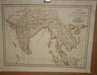 |
te287. map/Africa put into the basket Bonne, Rigobert: Partie Occidentale de L'Ancien Continent, depuis Lisbonne jusqu'a ls Riviere de Sierra Leona: Avec l'Isle Madere, les Isles Canaries, et celles du C. Verd.Paris. 1787. copper engraving.size: 32x21 cm. page: 40x26 cm. price: 34.09 EURO | 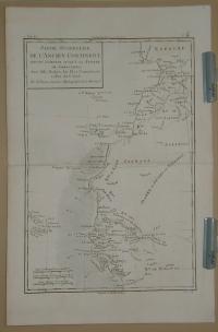 |
te288. map/Africa put into the basket Bonne, Rigobert: Carte de la Partie Septentrionale d'Afrique, ou de la Barbarie; Contenant les Royaumes de Tripoli, de Tunis, d'Alger, de Fez et de Maroc.Paris. 1787. copper engraving.size: 21x32 cm. page: 26x40 cm. minimaly stained. price: 25.57 EURO |  |
te314. map/Africa put into the basket Bonne, Rigobert: Carte du Canal de Mosambique, contenant l'Isle de Madagascar avec les Cotes d'Afrique depuis le Cap de Bonne Esperance, jusqu'a Melinde.Paris. 1787. copper engraving.size: 21x32 cm. page: 26x40 cm. minimaly stained. price: 51.14 EURO |  |
te315. map/Africa put into the basket Bonne, Rigobert: Carte de la Haute et de la Basse Guinée, depuis la Riviere de Sierra Leona, jusqu'au Cap Negro.Paris. 1787. copper engraving.size: 21x32 cm. page: 26x40 cm. price: 34.09 EURO |  |
te1207. map/Africa put into the basket Bonne, Rigobert: Carte de la Terre van-Diemen.Paris. ca.1780. copper engraving.size: 22x33 cm. page: 32x46 cm. price: 34.09 EURO |  |
te1221. map/Africa put into the basket Bonne, Rigobert: Royaumes Etats et Pays de la Haute Guinée.Paris. ca. 1780. copper engraving.size: 22x33 cm. page: 31x44 cm. price: 42.61 EURO | 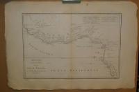 |
te1225. map/Africa put into the basket Bonne, Rigobert: Le Royaume D'Adel: Les Cotes D'Ajan et de Zanguebar.Paris. ca. 1780. copper engraving.size: 22x33 cm. page: 31x44 cm. price: 51.14 EURO | 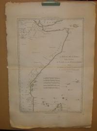 |
te1426. map/Africa put into the basket Plan und Ansicht von Algier.ca. 1860. steel engraving.size: 19x12 cm. page: 24x15 cm. price: 6.82 EURO | 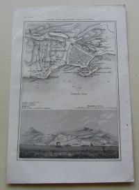 |
te1448. map/Africa put into the basket Scherer: Mappa Geographica Exhibens Religionem Catholicam Alicubi per Africam Sparsam.München. 1703. copper engraving.size: 21x33 cm. page: 27x40 cm. stained. price: 227.27 EURO | 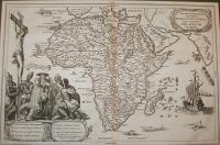 |
te1449. map/Africa put into the basket Scherer: Representatio Totius Africae.München. 1703. copper engraving.size: 21x34 cm. page: 27x40 cm. stained. price: 227.27 EURO |  |
te1461. map/Africa put into the basket Bonne, Rigobert:: La Basse Guinee, Contenant Les Royaumes De Loango, De Congo, D'Angola et de Benguela.Paris. ca.1780. copper engraving.size: 34x22 cm. page: 44x30 cm. price: 51.14 EURO |  |
te1530. map/Africa put into the basket Mollo, Tranquillo (kiadó): AFRICA.Wien. 1817. border colored copper engraving.size: 32x44 cm. page: 37x48 cm. stained outside the picture. price: 127.84 EUROMegjelent: Lehrbuch der Geographie, zeigt das Kaisertum Österreich nach dem Wiener Kongress. |  |
te170. map/America put into the basket Bonne, Rigobert: LES ISLES ANTILLES, ET LE GOLFE DU MÉXIQUE.Paris. 1787. copper engraving.size: 21x32 cm. page: 26x38 cm. in green paspartu. intact margin. price: 102.27 EUROJó állapotú. Good condotion.
A jobb felső sarokban a Bermudák. |  |
te173. map/America put into the basket Bonne, Rigobert: PARTIE MÉRIDIONALE, DE L'ANCIEN MÉXIQUE ( Mexico).Paris. 1787. copper engraving.size: 21x32 cm. page: 26x39 cm. in green paspartu. intact margin. price: 102.27 EUROJó állapotú. Good condition. | 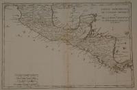 |
te175. map/America put into the basket Bonne, Rigobert: AMÉRIQUE MÉRIDIONALE ( South America).Paris. 1787. copper engraving.size: 32x21 cm. page: 39x26 cm. in green paspartu. minimaly stained outside the picture. price: 79.55 EURO | 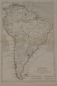 |
te193. map/America put into the basket Meyer: Staaten am Atlantischen Ocean.Hildburghausen. 1867. border colored steel engraving.size: 34x42 cm. page: 37x47 cm. intact margin. price: 51.14 EURO | 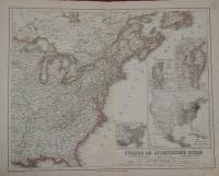 |
te230. map/America put into the basket Meyer: Südlichster Theil von America enthaltend Bolivia, das südliche Brasilien, Paraguay, Chile, La Plata, Cisplatina und Patagonien (South America).Hildburghausen. 1834. border colored steel engraving.size: 22x27 cm. page: 28x33 cm. price: 7.95 EUROstained. | 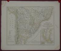 |
te290. map/America put into the basket Bonne, Rigobert: Les Isles de la Guadeloupe, de Marie Galante, de la Désirade, et celles des Saintes: Colonie Francoise dans les Antilles.Paris. 1787. copper engraving.size: 21x32 cm. page: 26x40 cm. price: 79.55 EURO |  |
te292. map/America put into the basket Bonne, Rigobert: Carte de l'Isle de St. Dominigue (Dominique) une des Grandes Antilles, Colonie Francoise et Espagnole.Paris. 1787. copper engraving.size: 21x32 cm. page: 26x40 cm. minimaly stained. price: 102.27 EURO |  |
te296. map/America put into the basket Bonne, Rigobert: Carte de la Partie Septentrionale du Bresil (South America).Paris. 1787. copper engraving.size: 21x32 cm. page: 26x40 cm. minimaly stained. price: 68.18 EURO |  |
te299. map/America put into the basket Bonne, Rigobert: La Guyane Francoise, avec partie de la Guyane Hollandoise: suivant les Opérations et les Cartes récentes des Ingénieurs-Géographes Francois (South America).Paris. 1787. copper engraving.size: 32x21 cm. page: 40x26 cm. price: 34.09 EURO | 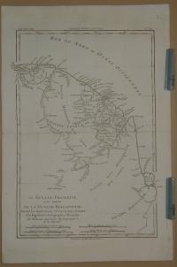 |
te954. map/America put into the basket Laurie & Whittle (published): AMERICA Divided Into North And South With Their Several Subdivisions.London. 1794. hand colored copper engraving.size: 49x52 cm. page: 54x73 cm. minimaly stained. price: 426.14 EUROCartographer:Kitchin, Thomas. | 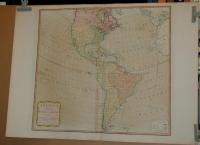 |
te1190. map/America put into the basket Güssefeld: CHARTE von AMERICA.Nürnberg. 1796. hand colored copper engraving.size: 56x43 cm. page: 64x52 cm. stained. price: 255.68 EURO | 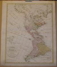 |
te1198. map/America put into the basket Güssefeld-Homann Erben: Charte uber die XIII vereingte Staaten von Nord-America.Nürnberg. 1784. hand colored copper engraving.size: 43x56 cm. page: 52x64 cm. stained. price: 426.14 EURO | 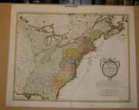 |
te1202. map/America put into the basket Bonne, Rigobert: Nouveau Royaume de GRENADE, Nouvelle ANDALOUSIE et GUYANE.Paris. ca. 1780. copper engraving.size: 22x33 cm. page: 31x46 cm. price: 51.14 EURO | 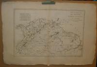 |
te1208. map/America put into the basket Bonne, Rigobert: Isles de la Reine Charlotte.Paris. ca.1780. copper engraving.size: 22x33 cm. page: 32x46 cm. price: 34.09 EURO | 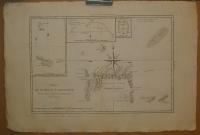 |
te1211. map/America put into the basket Bonne, Rigobert: Les Petites Antilles ou Les Isles Du Vent, avec Celles de Sous Le Vent.Paris. ca. 1780. copper engraving.size: 22x33 cm. page: 31x44 cm. price: 79.55 EURO |  |
te1215. map/America put into the basket Bonne, Rigobert: Isles Maidenland, de Hawkins, et le Detroit de Fakland.Paris. ca. 1780. copper engraving.size: 22x33 cm. page: 31x44 cm. price: 34.09 EUROFalklans szigetek. |  |
te1226. map/America put into the basket Bonne, Rigobert: Pérou et Pays Circonvoisins.Paris. ca. 1780. copper engraving.size: 22x33 cm. page: 31x44 cm. price: 68.18 EURORepública del Perú. |  |
te1227. map/America put into the basket Bonne, Rigobert: Bresil et Pays Des Amazones, avec Le Gouvernement De Buenos-Ayres I-II.Paris. ca. 1780. copper engraving.size: 22x33 cm. page: 31x44 cm. price: 71.02 EUROBrasilia. |  |
te1229. map/America put into the basket Bonne, Rigobert: L'Ancien et le Nouveau Mexique avec la Floride et la Basse Louisiane. Partie Orientale.Paris. ca. 1780. copper engraving.size: 22x33 cm. page: 31x44 cm. price: 127.84 EUROMexikó, Honduras, Nicaragua, Costa Rica. |  |
te1230. map/America put into the basket Bonne, Rigobert: Isles de Cuba et de la Jamaique.Paris. ca. 1780. copper engraving.size: 22x33 cm. page: 31x44 cm. price: 127.84 EURO |  |
te1231. map/America put into the basket Bonne, Rigobert: Isles de St. Domingue et celle de Porto Rico.Paris. ca. 1780. copper engraving.size: 22x33 cm. page: 31x44 cm. price: 102.27 EURODominica, Puerto Rico. |  |
te1520. map/America put into the basket Mollo, Tranquillo (kiadó): Charte von West-Indien.Wien. 1817. border colored copper engraving.size: 31x43 cm. page: 37x48 cm. stained outside the picture. price: 113.64 EUROMegjelent: Lehrbuch der Geographie, zeigt das Kaisertum Österreich nach dem Wiener Kongress. | 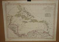 |
te1116. map/Hungary put into the basket Merian, Matthäus: Hungaria Regnum.Frankfurt. 1638. copper engraving.size: 26x31 cm. page: 31x37 cm. in green paspartu. price: 198.86 EURO | 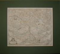 |
te1316. map/Hungary put into the basket [Mohács-Debrecen-Lippa].Nürnberg. 1688. copper engraving.size: 12x14 cm. page: 15x17 cm. in green paspartu. folded. price: 79.55 EURO | ![[Mohács-Debrecen-Lippa]](kep/th_terkep_1316_1.jpg) |
te11. map/France put into the basket Ortelius, Abraham: ANIOU (Anjou).Antwerpen. 1588. copper engraving.size: 9x11 cm. page: 12x15 cm. in green paspartu. intact margin. price: 51.14 EURO"Epitome". | 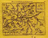 |
te24. map/France put into the basket Ortelius, Abraham: Veromandui.Antwerpen. 1588. copper engraving.size: 8x11 cm. page: 12x15 cm. in green paspartu. intact margin. price: 51.14 EURO"Epitome". | 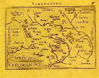 |
te41. map/France put into the basket Gabriel Bodenehr: Bethune in der Graffschaft Artois Mitt nahe anliegender Gegend.Augsburg. 1700. copper engraving.size: 17x28 cm. page: 18x31 cm. in green paspartu. price: 25.57 EUROStained at the middle. | 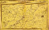 |
te42. map/France put into the basket Gabriel Bodenehr: Arras Mitt Nahe anliegender Gegend.Augsburg. 1700. copper engraving.size: 16x29 cm. in green paspartu. price: 19.89 EURO |  |
te44. map/France put into the basket Gabriel Bodenehr: Arien und St. Venand Mitt nahe Anliegender Gegend.Augsburg. 1700. copper engraving.size: 16x26 cm. in green paspartu. price: 19.89 EURO |  |
te283. map/France put into the basket Merian, Matthäus: Lotharingia ducatus; Vúlgo Lorraine.Frankfurt. 1695. copper engraving.size: 28x36 cm. page: 32x37 cm. price: 79.55 EURO |  |
te284. map/France put into the basket Merian, Matthäus: Sabaudia Ducatus Savoye.Frankfurt. 1695. copper engraving.size: 27x36 cm. page: 32x37 cm. stained. price: 79.55 EURO |  |
te285. map/France put into the basket Merian, Matthäus: Utriusque Burgundiae, tum Ducatus tum Comitatus Descriptio.Frankfurt. 1695. copper engraving.size: 27x36 cm. page: 32x37 cm. stained. price: 79.55 EURO |  |
te517. map/France put into the basket CARTE DE LA FRANCE DIVISÉE EN SES 83 DÉPARTEMENS.Paris. ca. 1821. copper engraving.size: 43x44 cm. page: 46x50 cm. price: 10.23 EURO |  |
te526. map/France put into the basket Sanson, Nicolas: LeGouvernement General Du Dauphiné.Paris. 1692. border colored copper engraving.size: 52x83 cm. page: 64x98 cm. stained. price: 113.64 EURO |  |
te527. map/France put into the basket Sanson, Nicolas: La Franche Comte divisee en Trois Grands Balliages scavoir d' Amont, d' Aval, et du Milieu ou de Dole.Paris. 1692. border colored copper engraving.size: 77x53 cm. page: 95x64 cm. intact margin. price: 113.64 EURO |  |
te528. map/France put into the basket Sanson, Nicolas: Gouvernement D'Orleans Et La Generalite.Paris. 1693. border colored copper engraving.size: 47x67 cm. page: 64x98 cm. intact margin. price: 113.64 EURO |  |
te963. map/France put into the basket Visscher Nicolaum: Galliae feu Franciae Tabula.Amsterdam. ca. 1710. hand colored copper engraving.size: 44x53 cm. page: 51x58 cm. intact margin. price: 340.91 EURO |  |
te1149. map/France put into the basket Sanson-Jaillot: Le Gouvernement General de L'Isle De France, ou la Generalite De Paris Divisée En Ses Eslectios.Paris. 1692. border colored copper engraving.size: 40x62 cm. page: 64x98 cm. clean, sharp issue. implosion on the margin. price: 142.05 EURO |  |
te1259. map/France put into the basket Münster: Gallia.Basel. ca.1560. wood engraving.size: 8x14 cm. page: 33x20 cm. stained. price: 12.78 EURO | 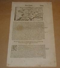 |
te1261. map/France put into the basket Münster: Gallia. Engellender und Burgunder miteinander in zwentracht waren/ ist sie in einen schlechten Stand und Wesen gerathen.Basel. ca.1560. wood engraving.size: 12x15 cm. page: 32x20 cm. price: 12.78 EURO | 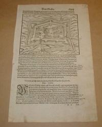 |
te1339. map/France put into the basket Topographische Karte von Paris und Gegend.Hildburghausen. ca. 1860. steel engraving.size: 22x27 cm. page: 24x30 cm. price: 5.11 EURO |  |
te1429. map/France put into the basket Sanson-Jaillot: La Lorraine, qui Comprend les Duches de Lorraine et de Bar et les Balliages des Evesches et des Villes de Metz, Toul, et Verdun.Paris. 1692. border colored copper engraving.size: 53x85 cm. page: 64x98 cm. implosion on the margin. price: 142.05 EURO |  |
te1430. map/France put into the basket Sanson-Jaillot: Seconde Partie du Gouvernement General de l' Isle de France, ou la Generalite de Paris.Paris. 1692. border colored copper engraving.size: 40x63 cm. page: 64x98 cm. price: 142.05 EURO |  |
te1431. map/France put into the basket Sanson-Jaillot: Le Comté de Haynaut divisé.Paris. 1692. border colored copper engraving.size: 51x71 cm. page: 64x98 cm. price: 142.05 EURO |  |
te31. map/Germany put into the basket Gabriel Bodenehr: Gelddern Eine Statt undHauptVeltung im Hertzog thum gleiches Nahmens gelgen Mitt dero Gegend aus fjStunden.Augsburg. ca 1700. border colored copper engraving.size: 17x24 cm. page: 20x32 cm. in green paspartu. intact margin. price: 51.14 EURO |  |
te32. map/Germany put into the basket Gabriel Bodenehr: Geldern nach Vor mahliger Befestigung.Augsburg. 1700. copper engraving.size: 16x26 cm. page: 21x32 cm. in green paspartu. intact margin. price: 51.14 EURO |  |
te139. map/Germany put into the basket Homann, Johann Baptist: Ducatus MEKLENBURGICI Tabula Generalis continens Duc: VANDALIAE et MEKLENBURG Comitatum et Episcopatum.Nürnberg. 1730. hand colored copper engraving.size: 49x57 cm. page: 52x59 cm. intact margin. price: 127.84 EURODecorative and highly detailed regional map, extending from Holstein and Lubeck in the west to Rugia and Pomerania in the east, and centered on Mecklenburg, Swerinensis, Vandalia, Rostochiense and Sta... |  |
te267. map/Germany put into the basket Münster, Sebastian: Germany (Deutschland).Basel. 1558. wood engraving.size: 12x15 cm. page: 31x21 cm. price: 17.05 EUROCosmographia
foltos/marked. |  |
te269. map/Germany put into the basket Münster, Sebastian: Germany (Deutschland).Basel. 1558. wood engraving.size: 13x15 cm. page: 31x21 cm. price: 17.05 EUROCosmographia
a képmezőn kívül foltos/marked outside the picture. |  |
te273. map/Germany put into the basket Münster, Sebastian: Germany (Deutschland).Basel. 1558. wood engraving.size: 12x16 cm. page: 31x21 cm. price: 17.05 EUROCosmographia
a képmezőn kívül foltos/marked outside the picture. |  |
te275. map/Germany put into the basket Münster, Sebastian: Germany (Deutschland).Basel. 1558. wood engraving.size: 22x16 cm. page: 31x21 cm. price: 17.05 EUROCosmographia
a képmezőn kívül foltos/marked outside the picture. |  |
te276. map/Germany put into the basket Münster, Sebastian: Germany (Deutschland).Basel. 1558. wood engraving.size: 10x13 cm. page: 31x20 cm. price: 17.05 EUROCosmographia. |  |
te378. map/Germany put into the basket Blaeu: Oldenburg Comitatus.Amsterdam. 1635. copper engraving.size: 38x50 cm. page: 41x54 cm. in blue paspartu. price: 170.45 EUROAttractive map of Oldenburg, also depicting Bremen. From the French edition of Willem Blaeu's atlas "Theatrum". |  |
te379. map/Germany put into the basket Blaeu: Monasteriensis Episcopatus.Amsterdam. 1635. copper engraving.size: 38x49 cm. page: 42x55 cm. in blue paspartu. minimaly stained outside the picture. price: 198.86 EUROAttractive map of Munster from "Theatrum Orbis Terrarum" or "Novus Atlas". |  |
te522. map/Germany put into the basket Sanson, Nicolas: Partie Occidentale Du Palatinat Et Eslectorat Du Rhein Le Duché De Simmeren, Les Comtés De Spanheim Et de Veldentz A La Maison Palatine.Paris. 1692. border colored copper engraving.size: 42x53 cm. page: 50x64 cm. minimaly stained outside the picture. price: 102.27 EURO |  |
te523. map/Germany put into the basket Sanson, Nicolas: Partie Orientale Du Temporel De L'Archevesché Et Eslectorat De Treves.Paris. 1692. border colored copper engraving.size: 41x54 cm. page: 50x64 cm. intact margin. price: 102.27 EURO |  |
te524. map/Germany put into the basket Sanson, Nicolas: Haute Partie De L'Eveschéde Munster.Paris. 1692. border colored copper engraving.size: 41x54 cm. page: 51x64 cm. intact margin. price: 102.27 EURO |  |
te525. map/Germany put into the basket Sanson, Nicolas: Basse Partie De L'Evesché De Munster Et Le Comté De Benthem.Paris. 1692. border colored copper engraving.size: 42x54 cm. page: 51x64 cm. intact margin. price: 102.27 EURO |  |
te570. map/Germany put into the basket Seutter, Matthäus: Principatus Calenberg et Grubenhagen, Comitatus Schauenburg Episcopatus Hildesiani et adjacentium terrarum descriptio georaphicacura et impensis.Augsburg. 1744. border colored copper engraving.size: 26x19 cm. page: 29x22 cm. in green paspartu. price: 79.55 EURO |  |
te571. map/Germany put into the basket Seutter, Matthäus: Ducatus Brunsuicensis juxta tres suos Principatus Calenbergic.nimir.et Grubenhagens. (sub Electore Brun.Lunaeb.Hanoverano) ac Guelpherbitanum (Duce Br.Lunaeb.Guelpherbitano).Augsburg. 1744. border colored copper engraving.size: 19x26 cm. page: 22x29 cm. in green paspartu. price: 79.55 EURO |  |
te572. map/Germany put into the basket Seutter, Matthäus: Trevirensis Archi-Episcopatus et Electoratus juxta omnes suas Praefecturas cum confini tractu.Augsburg. 1744. border colored copper engraving.size: 20x26 cm. page: 22x29 cm. in green paspartu. price: 79.55 EURO |  |
te574. map/Germany put into the basket Seutter, Matthäus: Mappa Circuli Rhenani Superiorisin quo oculis sistuntur landgr:Hasso-Cassel Darmstadiens:Rhenofeld: Abbatai Fuldensis, cura et stilo.Augsburg. 1744. border colored copper engraving.size: 20x26 cm. page: 22x30 cm. in green paspartu. price: 79.55 EURO |  |
te575. map/Germany put into the basket Seutter, Matthäus: Palatinatus Iferior, sive Electoratus Palatinus ad Rhenum cum adjacentibus Archi=Episcopatu Moguntino Episco: Spirensi, et Wormatiensi Cura et Studio.Augsburg. 1744. border colored copper engraving.size: 19x26 cm. page: 22x30 cm. in claret paspartu. price: 79.55 EURO |  |
te577. map/Germany put into the basket Seutter, Matthäus: Episcopatus Pader=Bornensis.Augsburg. 1744. border colored copper engraving.size: 19x25 cm. page: 22x29 cm. in green paspartu. price: 79.55 EURO |  |
te849. map/Germany put into the basket Brion De La Tour, Louis:: L'Alemagne Divisee En Tous Se Cercles.Paris. 1766. border colored copper engraving.size: 22x25 cm. page: 29x38 cm. in green paspartu. intact margin. price: 113.64 EURO |  |
te1105. map/Germany put into the basket Lotter: Saxoniae Superioris ....Electoralis Circulus: cum adiacentibus Ducatibus et Provinciis, simulque diligentissime annotatis Postarum Cursus et Stationes.Augsburg. 1745. hand colored copper engraving.size: 47x56 cm. page: 54x68 cm. price: 127.84 EURO |  |
te1106. map/Germany put into the basket Homann, Johann Baptist: OSELLAE FLUMINIS TABULA SPECIALIS IN QUA ARCHIEPISCOPATUS ET ELECTORATUS TREVIRENSIS.Nürnberg. ca. 1730. hand colored copper engraving.size: 47x56 cm. page: 51x59 cm. shabby. implosion on the margin. price: 71.02 EURO |  |
te1107. map/Germany put into the basket Homann, Johann Baptist: Ducatus Brunsuicensis in tres fuos Grubenhag.Nürnberg. ca.1730. hand colored copper engraving.size: 48x56 cm. page: 51x59 cm. trimmed. implosion on the margin. price: 71.02 EURO |  |
te1109. map/Germany put into the basket Homann, Johann Baptist: Exactissima Palatinatus ad Rheinum.Nürnberg. ca. 1730. hand colored copper engraving.size: 47x56 cm. page: 51x60 cm. stained outside the picture. trimmed. price: 127.84 EURO |  |
te1110. map/Germany put into the basket Homann, Johann Baptist: Ducatus Iuliaci & Bergensis Tabula Geographica, simul Ducatum Cliviae & Meursiae Principatum ... Ducat. Limburgensis.Nürnberg. ca. 1730. hand colored copper engraving.size: 55x46 cm. page: 59x51 cm. damaged. price: 99.43 EURO |  |
te1112. map/Germany put into the basket Sanson Nicolas: PARTIE ORIENTALE DU PALATINAT ET ESLECTORAT DU RHEIN. LES ÉVESCHÉS DE SPIRE, DE WORMES ET LE COMTÉ DE LINANGE.Paris. 1692. border colored copper engraving.size: 39x52 cm. page: 51x65 cm. price: 170.45 EURO |  |
te1113. map/Germany put into the basket Sanson Nicolas: Le Cercle de Franconie.Paris. 1692. border colored copper engraving.size: 51x84 cm. page: 64x98 cm. clean, sharp issue. price: 255.68 EURO |  |
te1114. map/Germany put into the basket Sanson Nicolas: La Basse Partie du Cercle du Haut Rhein.Paris. 1692. border colored copper engraving.size: 51x84 cm. page: 64x100 cm. clean, sharp issue. price: 255.68 EURO |  |
te1264. map/Germany put into the basket Münster: Die Statt Rusach.Basel. ca.1560. wood engraving.size: 24x34 cm. page: 33x40 cm. damaged. price: 34.09 EURO |  |
te144. map/United Kingdom put into the basket Homann Heredibus: Regionis qvae est circa Londinum (London) specialis repraesentatio geographica.1741. colored copper engraving.size: 50x56 cm. page: 55x65 cm. intact margin. price: 255.68 EUROAt the bottom, there is a very fine London Westminster city view. | 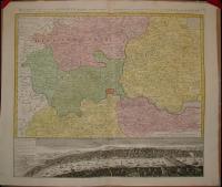 |
te250. map/United Kingdom put into the basket Homann, Johann Baptist: Magnae Britanniae Pars Meridionale, in qua Regnum Angliae.Nürnberg. ca. 1720. hand colored copper engraving.size: 56x48 cm. page: 61x53 cm. intact margin. price: 255.68 EUROIn the English Channel is an engraved vignette of Queen Anne in the House of Lords. | 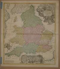 |
te438. map/United Kingdom put into the basket BRIT SZIGETEK.Budapest. ca. 1930. .size: 79x56 cm. page: 88x62 cm. intact margin. price: 4.26 EURO |  |
te516. map/United Kingdom put into the basket Homann Heredibus: Regnum Magnae Britanniae et Hiberniae Mappa Georgraphica.Nürnberg. 1749. hand colored copper engraving.size: 45x52 cm. page: 51x58 cm. minimaly stained outside the picture. minimal implosion on the margin. price: 170.45 EURO | 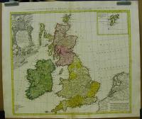 |
te959. map/United Kingdom put into the basket Robert De Vaugondy: Carte des grandes routes d'Angleterre, d'Ecosse, et d'Irlande. Par le Sr. Robert.Paris. 1757. border colored copper engraving.size: 45x56 cm. page: 54x82 cm. clean, sharp issue. intact margin. price: 198.86 EURO | 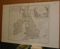 |
te1295. map/United Kingdom put into the basket Thorton William: Plan of Cheap Ward. Plan of Tower Street Ward.London. 1784. copper engraving.size: 31x19 cm. page: 39x25 cm. price: 17.05 EUROLondon. | 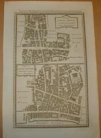 |
te1296. map/United Kingdom put into the basket Thorton William: Plan of Baynards Castle Ward. Plan of Canlewick and Langborn Wards.London. 1784. copper engraving.size: 30x18 cm. page: 39x25 cm. price: 17.05 EURO | 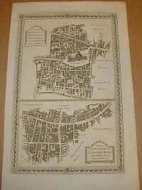 |
te1297. map/United Kingdom put into the basket Thorton William: Plan of Bishopsgate Ward. Plan of Alderagate Ward. Plan of Bread Street & Cordwaners Wards.London. 1784. copper engraving.size: 30x18 cm. page: 39x25 cm. price: 17.05 EURO | 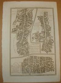 |
te1298. map/United Kingdom put into the basket Thorton William: Plan of Billingsgate Ward. Plan of Faringdon Ward.London. 1784. copper engraving.size: 30x18 cm. page: 39x25 cm. price: 17.05 EURO | 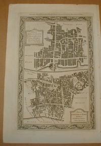 |
te1299. map/United Kingdom put into the basket Thorton William: Plan of Colemann Street. Plan of Portsoken Ward. Plan of Cripplegate Ward.London. 1784. copper engraving.size: 30x18 cm. page: 39x25 cm. price: 17.05 EURO | 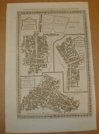 |
te1456. map/United Kingdom put into the basket Seutter, Matthaus: Tabula Novissima Accuratissima Regnorum Angliae, Scotiae, Hiberniae.Augsburg. ca.1725. hand colored copper engraving.size: 57x48 cm. page: 62x54 cm. price: 340.91 EURO | 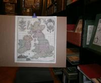 |
te1539. map/United Kingdom put into the basket Mollo, Tranquillo (kiadó): General Carte von Gross Brittannien.Wien. 1817. border colored copper engraving.size: 44x32 cm. page: 48x37 cm. stained outside the picture. price: 113.64 EUROMegjelent: Lehrbuch der Geographie, zeigt das Kaisertum Österreich nach dem Wiener Kongress. | 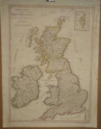 |
te28. map/Spain, Portugal put into the basket Ortelius, Abraham: Tercera Insula (Azori Island (Portugal, Acores, Azores).Antwerpen. 1588. copper engraving.size: 8x11 cm. page: 11x15 cm. in green paspartu. intact margin. price: 51.14 EURO"Epitome". | 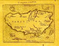 |
te317. map/Spain, Portugal put into the basket Bonne, Rigobert: Carte des Isles Canaries, avec l'Isle de Madere, et celle de Porto Santo. (Madeira).Paris. 1787. copper engraving.size: 32x21 cm. page: 40x26 cm. stained. price: 68.18 EURO | 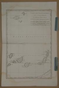 |
te558. map/Spain, Portugal put into the basket Cary, John: A New Map of the Kingdom of Portugal.London. 1801. hand colored copper engraving.size: 44x49 cm. page: 49x57 cm. intact margin. price: 79.55 EUROAz alján a hajtásnál 5 cm-es szakadás restaurálva.
At the bottom on the fold 5 cm implosion restored. | 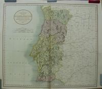 |
te1199. map/Spain, Portugal put into the basket Güssefeld-Homann Heredibus: Regnorum Hispaniae et Portugalliae Tabula generalis.Nürnberg. 1782. hand colored copper engraving.size: 44x55 cm. page: 52x64 cm. stained outside the picture. price: 255.68 EURO | 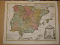 |
te1209. map/Spain, Portugal put into the basket Bonne, Rigobert: Isles Acores.Paris. ca.1780. copper engraving.size: 22x33 cm. page: 32x46 cm. price: 68.18 EUROAzori szigetek. |  |
te1433. map/Spain, Portugal put into the basket Charte von Portugal. Nach W. Faden.Weimar. 1801. border colored copper engraving.size: 69x48 cm. page: 76x55 cm. price: 127.84 EURO |  |
te20. map/Italy put into the basket Ortelius, Abraham: Perusia (Perugia).Antwerpen. 1588. copper engraving.size: 8x11 cm. page: 12x15 cm. in green paspartu. intact margin. price: 68.18 EURO"Epitome". |  |
te29. map/Italy put into the basket Ortelius, Abraham: Oropitum (Orvieto).Antwerpen. 1588. copper engraving.size: 8x11 cm. page: 12x15 cm. in green paspartu. intact margin. price: 68.18 EURO"Epitome". |  |
te543. map/Italy put into the basket Bertelli: Mola.Padova. 1629. copper engraving.size: 12x18 cm. page: 16x23 cm. price: 79.55 EURO | 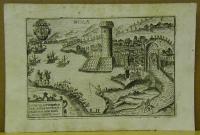 |
te546. map/Italy put into the basket Bertelli: Belitri.Padova. 1629. copper engraving.size: 12x18 cm. page: 16x23 cm. price: 79.55 EURO | 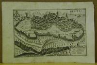 |
te547. map/Italy put into the basket Bertelli: Tivoli.Padova. 1629. copper engraving.size: 12x18 cm. page: 16x23 cm. price: 79.55 EURO | 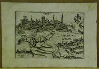 |
te549. map/Italy put into the basket Bertelli: Terracina.Padova. 1629. copper engraving.size: 12x18 cm. page: 16x23 cm. price: 79.55 EURO | 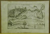 |
te550. map/Italy put into the basket Bertelli: Nocerra.Padova. 1629. copper engraving.size: 12x18 cm. page: 16x23 cm. price: 79.55 EURO | 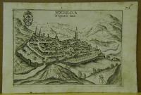 |
te552. map/Italy put into the basket Bertelli: Calatia.Padova. 1629. copper engraving.size: 12x18 cm. page: 16x23 cm. price: 79.55 EURO |  |
te1447. map/Italy put into the basket Le Bas, Jacques-Philippe: Plan de la Ville de Syracuse assiégée par les Athéniens.Paris. ca.1760. copper engraving.size: 17x24 cm. page: 25x27 cm. price: 25.57 EURO |  |
te1534. map/Italy put into the basket Mollo, Tranquillo (kiadó): Charte des LOMBARDISCH. VENETIANISCHEN Koenigreichs.Wien. 1817. border colored copper engraving.size: 32x44 cm. page: 37x48 cm. stained outside the picture. price: 113.64 EUROMegjelent: Lehrbuch der Geographie, zeigt das Kaisertum Österreich nach dem Wiener Kongress. |  |
te1536. map/Italy put into the basket Mollo, Tranquillo (kiadó): PARMA, PIAZENZA, GUASTALA. MODENA, LUKKA,.Wien. 1817. border colored copper engraving.size: 44x32 cm. page: 49x37 cm. stained outside the picture. price: 113.64 EUROMegjelent: Lehrbuch der Geographie, zeigt das Kaisertum Österreich nach dem Wiener Kongress. | 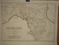 |
te30. map/Belgium put into the basket Gabriel Bodenehr: Charlemont.Augsburg. 1700. copper engraving.size: 15x19 cm. page: 20x28 cm. in green paspartu. intact margin. price: 22.73 EURO |  |
te33. map/Belgium put into the basket Gabriel Bodenehr: Namur.Augsburg. 1700. copper engraving.size: 15x19 cm. page: 20x29 cm. in green paspartu. intact margin. price: 34.09 EURO |  |
te35. map/Belgium put into the basket Gabriel Bodenehr: Namur mit dero Gegend auff 2 Stunden, etc.Augsburg. 1700. border colored copper engraving.size: 16x22 cm. page: 20x32 cm. in green paspartu. intact margin. price: 51.14 EURO |  |
te46. map/Hungarian county map put into the basket Gönczy Pál: Bars megye térképe.Budapest. 1888. .size: 45x32 cm. page: 56x44 cm. intact margin. price: 17.05 EURO | 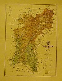 |
te48. map/Hungarian county map put into the basket Gönczy Pál: Varasd megye térképe.Budapest. 1890. .size: 31x45 cm. page: 44x57 cm. intact margin. price: 17.05 EURO | 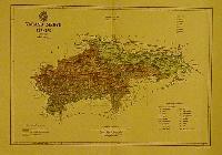 |
te52. map/Hungarian county map put into the basket Gönczy Pál: Pozsega megye térképe.Budapest. 1890. .size: 32x51 cm. page: 44x57 cm. intact margin. price: 17.05 EURO | 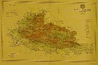 |
te53. map/Hungarian county map put into the basket Gönczy Pál: Zágráb megye térképe.Budapest. 1890. .size: 34x43 cm. page: 44x57 cm. intact margin. price: 17.05 EURO | 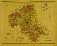 |
te54. map/Hungarian county map put into the basket Gönczy Pál: Lika-Krbava megye térképe.Budapest. 1890. .size: 33x42 cm. page: 44x57 cm. intact margin. price: 17.05 EURO |  |
te59. map/Hungarian county map put into the basket Gönczy Pál: Szerém megye térképe.Budapest. 1890. .size: 30x48 cm. page: 44x57 cm. intact margin. price: 17.05 EURO |  |
te70. map/Hungarian county map put into the basket Gönczy Pál: Alsó-Fehér megye térképe.Budapest. 1888. .size: 31x42 cm. page: 44x57 cm. intact margin. price: 17.05 EURO |  |
te416. map/Hungarian county map put into the basket Gönczy Pál: Győr vármegye térképe.Budapest. 1894. .size: 25x19 cm. page: 330x24 cm. intact margin. price: 3.41 EURO |  |
te485. map/Hungarian county map put into the basket Gönczy Pál: Belovár-Körös vármegye térképe.Budapest. ca 1900. .size: 21x28 cm. page: 24x30 cm. price: 3.41 EURO |  |
te495. map/Hungarian county map put into the basket Gönczy Pál: Nagy-Küküllő vármegye térképe.Budapest. ca 1900. .size: 20x26 cm. page: 24x30 cm. price: 5.11 EURO |  |
te514. map/Hungarian county map put into the basket Gönczy Pál: Szeben vármegye térképe.Budapest. ca 1900. .size: 20x27 cm. page: 24x30 cm. price: 3.41 EURO |  |
te967. map/Hungarian county map put into the basket Gönczy Pál: Vas vármegye.Budapest. 1894. .size: 24x30 cm. price: 3.41 EUROGönczy Pál (Hajdúszoboszló, 1817. dec. 26. – Karácsond, 1892. jan. 10.):
pedagógus, az MTA l. tagja (1858). 1834-től a debreceni kollégiumban bölcsészetet tanult, 1838-tól tanító, ill... |  |
te968. map/Hungarian county map put into the basket Gönczy Pál: Kis-Küküllő vármegye térképe.Budapest. 1894. .size: 24x30 cm. price: 3.41 EUROGönczy Pál (Hajdúszoboszló, 1817. dec. 26. – Karácsond, 1892. jan. 10.):
pedagógus, az MTA l. tagja (1858). 1834-től a debreceni kollégiumban bölcsészetet tanult, 1838-tól tanító, ill... |  |
te973. map/Hungarian county map put into the basket Gönczy Pál: Beszterce-Naszód vármegye térképe.Budapest. 1894. .size: 24x30 cm. price: 3.41 EUROGönczy Pál (Hajdúszoboszló, 1817. dec. 26. – Karácsond, 1892. jan. 10.):
pedagógus, az MTA l. tagja (1858). 1834-től a debreceni kollégiumban bölcsészetet tanult, 1838-tól tanító, ill.... |  |
te975. map/Hungarian county map put into the basket Gönczy Pál: Lika-Krbava vármegye térképe. Croatia.Budapest. 1894. .size: 24x30 cm. price: 4.26 EUROGönczy Pál (Hajdúszoboszló, 1817. dec. 26. – Karácsond, 1892. jan. 10.):
pedagógus, az MTA l. tagja (1858). 1834-től a debreceni kollégiumban bölcsészetet tanult, 1838-tól tanító, ill.... | 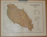 |
te977. map/Hungarian county map put into the basket Gönczy Pál: Arad vármegye térképe.Budapest. 1894. .size: 24x30 cm. price: 4.26 EUROGönczy Pál (Hajdúszoboszló, 1817. dec. 26. – Karácsond, 1892. jan. 10.):
pedagógus, az MTA l. tagja (1858). 1834-től a debreceni kollégiumban bölcsészetet tanult, 1838-tól tanító, ill.... |  |
te978. map/Hungarian county map put into the basket Gönczy Pál: Alsó-Fehér vármegye térképe.Budapest. 1894. .size: 24x30 cm. price: 3.41 EUROGönczy Pál (Hajdúszoboszló, 1817. dec. 26. – Karácsond, 1892. jan. 10.):
pedagógus, az MTA l. tagja (1858). 1834-től a debreceni kollégiumban bölcsészetet tanult, 1838-tól tanító, ill.... |  |
te987. map/Hungarian county map put into the basket Gönczy Pál: Szerém vármegye térképe.Budapest. 1894. .size: 24x30 cm. price: 3.41 EUROGönczy Pál (Hajdúszoboszló, 1817. dec. 26. – Karácsond, 1892. jan. 10.):
pedagógus, az MTA l. tagja (1858). 1834-től a debreceni kollégiumban bölcsészetet tanult, 1838-tól tanító, ill.... |  |
te989. map/Hungarian county map put into the basket Gönczy Pál: Szolnok-Doboka vármegye térképe.Budapest. 1894. .size: 24x30 cm. price: 3.41 EUROGönczy Pál (Hajdúszoboszló, 1817. dec. 26. – Karácsond, 1892. jan. 10.):
pedagógus, az MTA l. tagja (1858). 1834-től a debreceni kollégiumban bölcsészetet tanult, 1838-tól tanító, ill.... |  |
te993. map/Hungarian county map put into the basket Gönczy Pál: Modrus-Fiume vármegye térképe.Budapest. 1894. .size: 24x30 cm. price: 3.41 EUROGönczy Pál (Hajdúszoboszló, 1817. dec. 26. – Karácsond, 1892. jan. 10.):
pedagógus, az MTA l. tagja (1858). 1834-től a debreceni kollégiumban bölcsészetet tanult, 1838-tól tanító, ill.... |  |
te998. map/Hungarian county map put into the basket Gönczy Pál: Varasd vármegye térképe.Budapest. 1894. .size: 24x30 cm. price: 3.41 EUROGönczy Pál (Hajdúszoboszló, 1817. dec. 26. – Karácsond, 1892. jan. 10.):
pedagógus, az MTA l. tagja (1858). 1834-től a debreceni kollégiumban bölcsészetet tanult, 1838-tól tanító, ill.... |  |
te999. map/Hungarian county map put into the basket Gönczy Pál: Verőce vármegye térképe.Budapest. 1894. .size: 24x30 cm. price: 3.41 EUROGönczy Pál (Hajdúszoboszló, 1817. dec. 26. – Karácsond, 1892. jan. 10.):
pedagógus, az MTA l. tagja (1858). 1834-től a debreceni kollégiumban bölcsészetet tanult, 1838-tól tanító, ill.... |  |
te1000. map/Hungarian county map put into the basket Gönczy Pál: Veszprém vármegye térképe, Balaton.Budapest. 1894. .size: 24x30 cm. price: 7.1 EUROGönczy Pál (Hajdúszoboszló, 1817. dec. 26. – Karácsond, 1892. jan. 10.):
pedagógus, az MTA l. tagja (1858). 1834-től a debreceni kollégiumban bölcsészetet tanult, 1838-tól tanító, ill.... |  |
te1001. map/Hungarian county map put into the basket Gönczy Pál: Zágráb vármegye térképe.Budapest. 1894. .size: 24x30 cm. price: 3.41 EUROGönczy Pál (Hajdúszoboszló, 1817. dec. 26. – Karácsond, 1892. jan. 10.):
pedagógus, az MTA l. tagja (1858). 1834-től a debreceni kollégiumban bölcsészetet tanult, 1838-tól tanító, ill.... |  |
te1004. map/Hungarian county map put into the basket Gönczy Pál: Pozsega vármegye térképe. Požega, Požeška županija.Budapest. 1894. .size: 24x30 cm. price: 4.26 EUROCroatia,
Gönczy Pál (Hajdúszoboszló, 1817. dec. 26. – Karácsond, 1892. jan. 10.): pedagógus, az MTA l. tagja (1858). 1834-től a debreceni kollégiumban bölcsészetet tanult, 1838-tól tan... |  |
te1006. map/Hungarian county map put into the basket Gönczy Pál: Csanád vármegye térképe.Budapest. 1894. .size: 24x30 cm. price: 3.41 EUROGönczy Pál (Hajdúszoboszló, 1817. dec. 26. – Karácsond, 1892. jan. 10.):
pedagógus, az MTA l. tagja (1858). 1834-től a debreceni kollégiumban bölcsészetet tanult, 1838-tól tanító, ill.... |  |
te1007. map/Hungarian county map put into the basket Gönczy Pál: Torontál vármegye térképe.Budapest. 1894. .size: 30x24 cm. price: 4.26 EUROGönczy Pál (Hajdúszoboszló, 1817. dec. 26. – Karácsond, 1892. jan. 10.):
pedagógus, az MTA l. tagja (1858). 1834-től a debreceni kollégiumban bölcsészetet tanult, 1838-tól tanító, ill.... |  |
te1008. map/Hungarian county map put into the basket Gönczy Pál: Tolna vármegye térképe.Budapest. 1894. .size: 30x24 cm. price: 4.26 EUROGönczy Pál (Hajdúszoboszló, 1817. dec. 26. – Karácsond, 1892. jan. 10.):
pedagógus, az MTA l. tagja (1858). 1834-től a debreceni kollégiumban bölcsészetet tanult, 1838-tól tanító, ill.... |  |
te1011. map/Hungarian county map put into the basket Gönczy Pál: Ugocsa vármegye térképe.Budapest. 1894. .size: 30x24 cm. price: 3.41 EUROGönczy Pál (Hajdúszoboszló, 1817. dec. 26. – Karácsond, 1892. jan. 10.):
pedagógus, az MTA l. tagja (1858). 1834-től a debreceni kollégiumban bölcsészetet tanult, 1838-tól tanító, ill.... |  |
te1013. map/Hungarian county map put into the basket Gönczy Pál: Borsod vármegye térképe.Budapest. 1894. .size: 30x24 cm. price: 3.41 EUROGönczy Pál (Hajdúszoboszló, 1817. dec. 26. – Karácsond, 1892. jan. 10.):
pedagógus, az MTA l. tagja (1858). 1834-től a debreceni kollégiumban bölcsészetet tanult, 1838-tól tanító, ill.... |  |
te1020. map/Hungarian county map put into the basket Gönczy Pál: Jász-Kun-Szolnok vármegye térképe.Budapest. 1894. .size: 30x24 cm. price: 3.41 EUROGönczy Pál (Hajdúszoboszló, 1817. dec. 26. – Karácsond, 1892. jan. 10.):
pedagógus, az MTA l. tagja (1858). 1834-től a debreceni kollégiumban bölcsészetet tanult, 1838-tól tanító, ill.... |  |
te1024. map/Hungarian county map put into the basket Gönczy Pál: Ung vármegye térképe.Budapest. 1894. .size: 30x24 cm. price: 3.41 EUROGönczy Pál (Hajdúszoboszló, 1817. dec. 26. – Karácsond, 1892. jan. 10.):
pedagógus, az MTA l. tagja (1858). 1834-től a debreceni kollégiumban bölcsészetet tanult, 1838-tól tanító, ill.... |  |
te1027. map/Hungarian county map put into the basket Gönczy Pál: Szepes vármegye térképe.Budapest. 1894. .size: 30x24 cm. price: 3.41 EUROGönczy Pál (Hajdúszoboszló, 1817. dec. 26. – Karácsond, 1892. jan. 10.):
pedagógus, az MTA l. tagja (1858). 1834-től a debreceni kollégiumban bölcsészetet tanult, 1838-tól tanító, ill.... |  |
te1034. map/Hungarian county map put into the basket Gönczy Pál: Csongrád vármegye térképe.Budapest. 1894. .size: 30x24 cm. price: 3.41 EUROGönczy Pál (Hajdúszoboszló, 1817. dec. 26. – Karácsond, 1892. jan. 10.):
pedagógus, az MTA l. tagja (1858). 1834-től a debreceni kollégiumban bölcsészetet tanult, 1838-tól tanító, ill.... |  |
te1473. map/Hungarian county map put into the basket Gönczy Pál: Sáros megye.Budapest. 1885. .size: 35x44 cm. page: 44x57 cm. price: 17.05 EURO |  |
te1481. map/Hungarian county map put into the basket Gönczy Pál: Modrus-Fiume megye.Budapest. 1885. .size: 35x44 cm. page: 44x57 cm. price: 17.05 EURO |  |
te1482. map/Hungarian county map put into the basket Gönczy Pál: Belovár-Kőrös megye.Budapest. 1885. .size: 35x44 cm. page: 44x57 cm. price: 17.05 EURO | 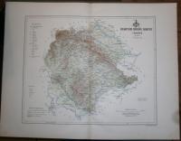 |
te1504. map/Hungarian county map put into the basket Vesprém megye térképe.Bp. 1982. .size: 67x79 cm. price: 1.7 EUROHajtogatott. |  |
te1505. map/Hungarian county map put into the basket Vas megye térképe.Bp. 1986. .size: 57x79 cm. price: 1.7 EUROHajtogatott. |  |
te1507. map/Hungarian county map put into the basket Csongrád megye térképe.Bp. 1978. .size: 58x79 cm. price: 1.7 EUROHajtogatott. |  |
te1509. map/Hungarian county map put into the basket Csongrád megye térképe.Bp. 1982. .size: 57x79 cm. stained. price: 1.14 EUROHajtogatott. | 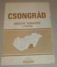 |
te1510. map/Hungarian county map put into the basket Békés megye térképe.Bp. 1978. .size: 91x79 cm. price: 1.7 EUROHajtogatott. | 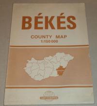 |
te1511. map/Hungarian county map put into the basket Szolnok megye térképe.Bp. 1982. .size: 91x79 cm. price: 1.7 EUROHajtogatott. | 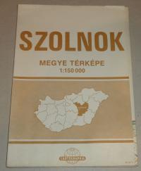 |
te1140. map/Scandinavia, Island put into the basket Seutter, Matthäus: Descriptio Nova et Accurata Scaniae, Blekingiae et Hallandiae.Augsburg. ca.1730. hand colored copper engraving.size: 47x56 cm. page: 54x63 cm. stained. price: 255.68 EURORestaurált. | 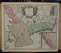 |
te336. map/Indinesia put into the basket Fremin: Skizzirte charte von der Insel Celebes.Prag. 1812. copper engraving.size: 27x18 cm. page: 32x20 cm. price: 25.57 EURO | 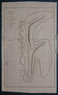 |
te1072. map/Russia put into the basket Robert De Vaugondy: SIBERIA, KAMCHATKA ,Russia.Paris. 1797. hand colored copper engraving.size: 45x59 cm. page: 56x76 cm. minimaly stained outside the picture. price: 170.45 EUROThis is a nice coloured, grand copper engraving map of Robert de Vaugondy. This map shows Siberia, the Kamchatka Peninsula as well as the adjacent areas. The map is decorated with a very decorative t... |  |
te1272. map/Russia put into the basket AA VAN DER PIERRE: LA MOSCOVIE SEPTENTRIONALE, SUIVANT LES NOUVELLES OBSERVATIONS.Leiden. 1714. copper engraving.size: 21x28 cm. page: 26x40 cm. folded. price: 71.02 EUROMap of northern Russia in Europe. |  |
te1273. map/Russia put into the basket AA VAN DER PIERRE: LA MOSCOVIE SEPTENTRIONALE, SUIVANT LES NOUVELLES OBSERVATIONS.Leiden. 1714. copper engraving.size: 21x29 cm. page: 26x40 cm. folded. price: 71.02 EUROMap of southern Russia in Europe. |  |
te1518. map/Russia put into the basket Mollo, Tranquillo (kiadó): Karte von Russland in Europa.Wien. 1817. border colored copper engraving.size: 43x31 cm. page: 48x37 cm. price: 113.64 EUROMegjelent: Lehrbuch der Geographie, zeigt das Kaisertum Österreich nach dem Wiener Kongress. | 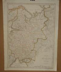 |
te146. map/Scotland put into the basket Johan Baptist Homann: Magnae Britanni, Pars Septentrionalis Regnum Scotiae in Suas Partes et subja centes Insulas divisum Accurata Tabula ex archetypo Vischeriano desumta exhibetur imitatore.1720. colored copper engraving.size: 57x47 cm. page: 63x53 cm. in green paspartu. intact margin. price: 198.86 EUROstained/foltos. | 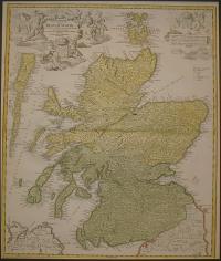 |
te1043. map/Scotland put into the basket Visscher Nicolaum: Exactissima Regni Scotiae Tabula.Amsterdam. 1689. hand colored copper engraving.size: 54x45 cm. page: 61x53 cm. price: 312.5 EUROA fokhálózaton 4 mm-es lyuk van.
Homann Skócia e térkép alapján készült. A hátlapon holland-angol nyelvű helymutató. Irodalom: http://www.geo.ed.ac.uk:81/~rsgs/ifa/gems/MapScot.html. | 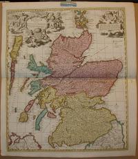 |
te149. map/Austria put into the basket Homann, Johann Baptist: Nova et accurata Carinthiae Ducatus tabula geographica.Nürnberg. ca 1730. colored copper engraving.size: 51x60 cm. page: 54x64 cm. in green paspartu. intact margin. price: 198.86 EUROAlul Klagenfurt látkép.
Fine city view at the bottom. | 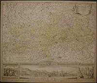 |
te567. map/Austria put into the basket Seutter, Matthäus: Archiducatus Austriae Superioris Ditiones in quas Quadrantes divisas.Augsburg. 1744. border colored copper engraving.size: 20x26 cm. page: 22x29 cm. in green paspartu. price: 102.27 EURO |  |
te592. map/Austria put into the basket Blaeu: Saltzburg Archiepiscopatus, et Carinthia Ducatus.Amsterdam. ca 1635. copper engraving.size: 39x50 cm. price: 198.86 EUROKörülvágva! Trimmed!. |  |
te1039. map/Austria put into the basket Homann, Johann Baptist: Principatus et archiepiscopatus Salisburgensis.Nürnberg. ca. 1730. hand colored copper engraving.size: 46x55 cm. page: 54x63 cm. minimaly stained outside the picture. price: 198.86 EURO |  |
te1326. map/Austria put into the basket Carintia.Nürnberg. 1688. copper engraving.size: 12x14 cm. page: 15x17 cm. in claret paspartu. folded. price: 45.45 EURO | 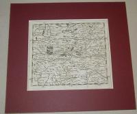 |
te1219. map/Canada put into the basket Bonne, Rigobert: Isle et Banc de Terre-Neuve, Isle Royale et Isle St. Jean; avec l'Acadie ou la Nouvelle Ecosse.Paris. ca. 1780. copper engraving.size: 22x33 cm. page: 31x44 cm. price: 102.27 EURO |  |
te366. map/Hungarian city map, tourist put into the basket A Zempléni-hegység túristatérképe. Déli rész.Budapest. 1984. .size: 67x47 cm. price: 1.7 EUROHajtogatott. | 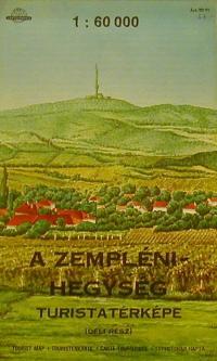 |
te367. map/Hungarian city map, tourist put into the basket A Soproni-hegység turistatérképe.Budapest. 1989. .size: 47x67 cm. shabby. price: 1.7 EUROHajtogatott. | 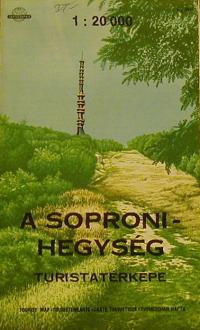 |
te368. map/Hungarian city map, tourist put into the basket A Mecsek turistatérképe.Budapest. 1992. .size: 67x94 cm. price: 1.99 EUROHajtogatott. | 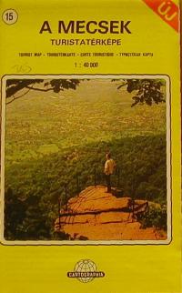 |
te1371. map/Hungarian city map, tourist put into the basket A Budai-hegység turistatérképe.Budapest. 1988. .size: 66x98 cm. price: 1.99 EURO | 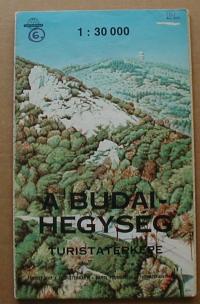 |
te1372. map/Hungarian city map, tourist put into the basket A Balaton turistatérképe.Budapest. 2001. .size: 72x117 cm. price: 1.7 EURO | 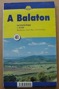 |
te1375. map/Hungarian city map, tourist put into the basket A Mátra turistatérképe.Budapest. 1982. .size: 67x98 cm. price: 1.99 EURO | 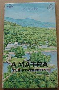 |
te1377. map/Hungarian city map, tourist put into the basket Aggtelek, Jósvafő és környékének turistatérképe.Budapest. 1985. .size: 67x47 cm. price: 1.42 EURO | 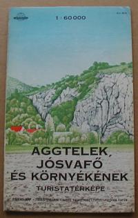 |
te1380. map/Hungarian city map, tourist put into the basket A Bakony turistatérképe. Déli rész.Budapest. 1988. .size: 80x120 cm. price: 1.99 EURO | 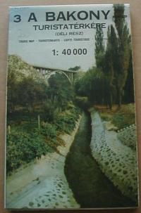 |
te1381. map/Hungarian city map, tourist put into the basket A Bakony turistatérképe. Északi rész.Budapest. 1988. .size: 80x120 cm. price: 1.99 EURO | 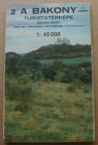 |
te1383. map/Hungarian city map, tourist put into the basket A Velencei-tó és környékének turistatérképe.Budapest. 1989. .size: 67x47 cm. price: 1.7 EURO | 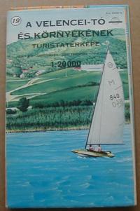 |
te1543. map/Hungarian city map, tourist put into the basket SOPRON és környéke. 1.75000.Bp. ca. 1930. .size: 19x26 cm. page: 21x29 cm. price: 4.26 EURO | 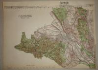 |
te1446. map/Greece put into the basket Münster, Sebastian: Creta oder Candia.Basel. 1558. wood engraving.size: 7x15 cm. page: 30x20 cm. stained outside the picture. price: 68.18 EURO |  |
te953. map/The Netherlands put into the basket Laurie & Whittle: A New Map of the Seat of War, in the Netherlands, from the best Authorities.London. 1794. hand colored copper engraving.size: 46x63 cm. page: 54x73 cm. folded. price: 198.86 EURO |  |
te1531. map/The Netherlands put into the basket Mollo, Tranquillo (kiadó): NIEDERLAND.Wien. 1817. border colored copper engraving.size: 43x31 cm. page: 48x37 cm. stained outside the picture. price: 113.64 EUROMegjelent: Lehrbuch der Geographie, zeigt das Kaisertum Österreich nach dem Wiener Kongress
Az alsó szélén szakadás. |  |
te1532. map/The Netherlands put into the basket Mollo, Tranquillo (kiadó): Karte von HOLLAND.Wien. 1817. border colored copper engraving.size: 32x44 cm. page: 37x48 cm. stained outside the picture. price: 68.18 EUROMegjelent: Lehrbuch der Geographie, zeigt das Kaisertum Österreich nach dem Wiener Kongress. |  |
te261. map/Israel, Palestine, Judaica put into the basket Homann (Heirs) /Harenberg/: PALAESTINA in XII. TRIBUS divisa, CUM TERRIS ADIACENTIBUS denuo revisa & copiosior reddita.Nürnberg. 1750. hand colored copper engraving.size: 44x51 cm. page: 55x62 cm. intact margin. price: 340.91 EURO | 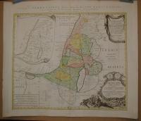 |
te800. map/Israel, Palestine, Judaica put into the basket Lapie: Carte de la Syrie et de L'Egypte anciennes.Paris. 1851. copper engraving.size: 53x37 cm. page: 66x50 cm. intact margin. price: 85.23 EURO | 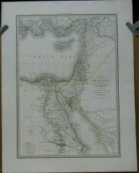 |
te943. map/Israel, Palestine, Judaica put into the basket Jansonii, Ioannis (1588-1664) (Janssonius): SITUS TERRAE PROMISSIONIS S.S. Bibliorum intelligentiam exacte aperiens per Chr. Adrichom.Amsterdam. um. 1650. copper engraving.size: 34x48 cm. page: 48x56 cm. clean, sharp issue. minimal implosion on the margin. price: 312.5 EURO | 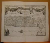 |
te947. map/Israel, Palestine, Judaica put into the basket ADRICHOM CHRISTIAN (Christian Van Adrichem): Dimidia Tribus Manasse.Köln. ca. 1590. copper engraving.size: 22x45 cm. page: 37x45 cm. trimmed. price: 102.27 EURO | 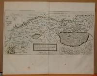 |
te363. map/Modern map put into the basket Vienna. Wien. Bécs térkép.Budapest. 1989. .size: 96x60 cm. price: 0.85 EUROHajtogatott. | 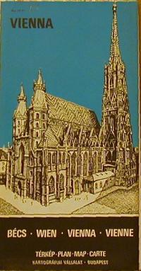 |
te369. map/Modern map put into the basket A Magas-Tátra turistatérképe.Budapest. 1987. .size: 55x62 cm. price: 1.42 EUROHajtogatott. | 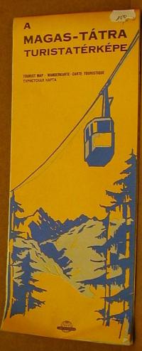 |
te764. map/military before 1945 put into the basket Nagykanizsa és Bjelovar.without year. .size: 57x40 cm. page: 64x47 cm. price: 4.26 EURO1:200000. |  |
te766. map/military before 1945 put into the basket Budapest É(szak).without year. .size: 39x57 cm. page: 47x64 cm. price: 5.11 EURO1:200000
Színes kiemelés. |  |
te828. map/military before 1945 put into the basket Ungvár.without year. .size: 57x37 cm. page: 63x47 cm. price: 4.26 EURO1:200000. |  |
te1153. map/Danube put into the basket Hondii Henrici (Hondius): Maximi Totius Europae Fluminis Danubii cursus.Amsterdam. ca. 1630. hand colored copper engraving.size: 43x49 cm. page: 46x56 cm. price: 426.14 EUROAlsó,felső szélén megvágva. |  |
te1527. map/Poland put into the basket Mollo, Tranquillo (kiadó): Schleisen ( POLEN).Wien. 1817. border colored copper engraving.size: 31x43 cm. page: 37x48 cm. stained outside the picture. price: 113.64 EUROMegjelent: Lehrbuch der Geographie, zeigt das Kaisertum Österreich nach dem Wiener Kongress. |  |
te1067. map/Ireland put into the basket Tirion, Isaak: Nieuwe Kaart van Ierland. Ireland.Amsterdam. ca. 1740. hand colored copper engraving.size: 32x25 cm. page: 41x50 cm. minimaly stained outside the picture. folded. price: 198.86 EURO |  |
te1079. map/Ireland put into the basket Robert De Vaugondy: L'Irlande.Paris. ca. 1760. border colored copper engraving.size: 22x21 cm. page: 29x41 cm. clean, sharp issue. price: 127.84 EURO | 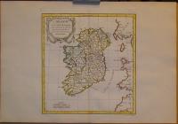 |
te955. map/Japan put into the basket Robert De Vaugondy: L'Empire Du Japon divisé en sept principales parties, et subdivisé en soixante et six Royaumes.Paris. 1750. border colored copper engraving.size: 46x52 cm. page: 54x79 cm. price: 511.36 EURO | 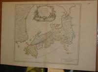 |
te1145. map/Serb, Croatian, Slovenian put into the basket Seutter, Matthäus: EXACTISSIMA DUCATUS CARNIOLAE VINIDORUM MARCHIÄ ET HISTRIAE DELINEATIO.Augsburg. ca. 1730. hand colored copper engraving.size: 47x55 cm. page: 54x62 cm. in green paspartu. stained outside the picture. price: 340.91 EURO | 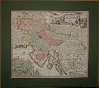 |
te1434. map/China put into the basket Bonne, Rigobert: Empire de la Chine Rme de Corée et Isles du Japon.Paris. 1787. copper engraving.size: 22x34 cm. page: 31x44 cm. price: 102.27 EUROKorea
Japan. | 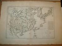 |
te1521. map/China put into the basket Mollo, Tranquillo (kiadó): Chinesischen Reich.Wien. 1817. border colored copper engraving.size: 31x43 cm. page: 37x48 cm. stained outside the picture. price: 127.84 EUROMegjelent: Lehrbuch der Geographie, zeigt das Kaisertum Österreich nach dem Wiener Kongress. | 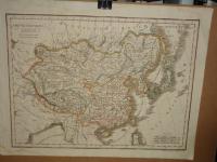 |
te1204. map/Australia, Oceanian put into the basket Bonne, Rigobert: Carte du Gouvernement de Bretagne. Assujettie au ciel et projettee.Paris. ca.1780. copper engraving.size: 22x33 cm. page: 32x46 cm. price: 34.09 EUROPapua New Guinea. |  |
te1205. map/Australia, Oceanian put into the basket Bonne, Rigobert: Isles des Nouvelles Hébrides, et celle de la Nouvelle Calédonie. ( France , Vanuatu ).Paris. ca.1780. copper engraving.size: 22x33 cm. page: 32x46 cm. price: 42.61 EURO |  |
te1210. map/Australia, Oceanian put into the basket Bonne, Rigobert: Carte des Isles de la Societé.Paris. ca. 1780. copper engraving.size: 22x33 cm. page: 31x44 cm. price: 68.18 EUROFrancia Polinézia. Társaság szigetek. |  |
te1217. map/Australia, Oceanian put into the basket Bonne, Rigobert: Carte des Isles des Amis.Paris. ca. 1780. copper engraving.size: 22x33 cm. page: 31x44 cm. price: 45.45 EUROTongataboo, Wateeoo. | 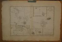 |
te1220. map/Australia, Oceanian put into the basket Bonne, Rigobert: Esquisse de la Baye Dusky, dans la Nouvelle Zeelande.Paris. ca. 1780. copper engraving.size: 22x33 cm. page: 31x44 cm. price: 34.09 EURO | 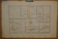 |
te1222. map/Australia, Oceanian put into the basket Bonne, Rigobert: Galles Meridle. ou Cote Orientale de la Nouvelle Hollande.Paris. ca. 1780. copper engraving.size: 22x33 cm. page: 31x44 cm. price: 68.18 EURO |  |
te1315. map/ put into the basket Neuester Plan von Ofen und Pesth in acht Farben gedruckt. Mit Angabe der Strassen und Gassen Namen.Pesth. 1849. lithography.size: 16x10 cm. price: 1278.41 EUROPlan von Ofen und Pest.34x52 cm, 42x60 cm
Plan oder Umgebungen von Ofen und Pest. 34x52 cm, 44x60 cm Walzel kőnyomatos térképe, körülötte Fuchsthaller 13 acélmetszetével Fabó-Holló/14... | 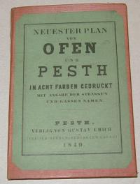 |
