The oldest virtual antiquarium in Hungary.

Sós Antikvárium
Designed and made byte276. map/Germany put into the basket Münster, Sebastian: Germany (Deutschland).Basel. 1558. wood engraving.size: 10x13 cm. page: 31x20 cm. price: 16.9 EUROCosmographia. | 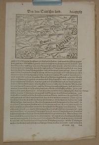 |
te275. map/Germany put into the basket Münster, Sebastian: Germany (Deutschland).Basel. 1558. wood engraving.size: 22x16 cm. page: 31x21 cm. price: 16.9 EUROCosmographia
a képmezőn kívül foltos/marked outside the picture. | 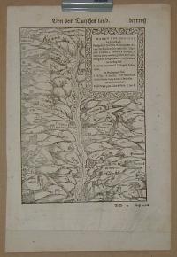 |
te1347. map/Russia put into the basket Das Europaische Russland.Hildburghausen. 1836. colored steel engraving.size: 25x18 cm. page: 30x25 cm. price: 12.68 EURO | 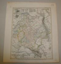 |
te1350. map/Russia put into the basket Pontus Euxinus et Regio.Wien. ca.186. border colored steel engraving.size: 19x25 cm. page: 25x31 cm. price: 7.04 EURO | 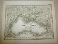 |
te1257. map/Russia put into the basket Pobuda: Plan von St. Petersburg.ca.1850. .size: 17x24 cm. page: 23x31 cm. stained. folded. price: 6.76 EURO | 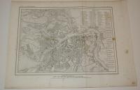 |
te1273. map/Russia put into the basket AA VAN DER PIERRE: LA MOSCOVIE SEPTENTRIONALE, SUIVANT LES NOUVELLES OBSERVATIONS.Leiden. 1714. copper engraving.size: 21x29 cm. page: 26x40 cm. folded. price: 70.42 EUROMap of southern Russia in Europe. |  |
te1272. map/Russia put into the basket AA VAN DER PIERRE: LA MOSCOVIE SEPTENTRIONALE, SUIVANT LES NOUVELLES OBSERVATIONS.Leiden. 1714. copper engraving.size: 21x28 cm. page: 26x40 cm. folded. price: 70.42 EUROMap of northern Russia in Europe. |  |
te1259. map/France put into the basket Münster: Gallia.Basel. ca.1560. wood engraving.size: 8x14 cm. page: 33x20 cm. stained. price: 12.68 EURO | 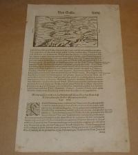 |
te1261. map/France put into the basket Münster: Gallia. Engellender und Burgunder miteinander in zwentracht waren/ ist sie in einen schlechten Stand und Wesen gerathen.Basel. ca.1560. wood engraving.size: 12x15 cm. page: 32x20 cm. price: 12.68 EURO | 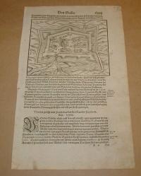 |
te1339. map/France put into the basket Topographische Karte von Paris und Gegend.Hildburghausen. ca. 1860. steel engraving.size: 22x27 cm. page: 24x30 cm. price: 5.07 EURO | 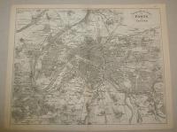 |
te1209. map/Spain, Portugal put into the basket Bonne, Rigobert: Isles Acores.Paris. ca.1780. copper engraving.size: 22x33 cm. page: 32x46 cm. price: 67.61 EUROAzori szigetek. | 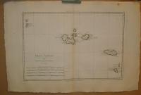 |
te1217. map/Australia, Oceanian put into the basket Bonne, Rigobert: Carte des Isles des Amis.Paris. ca. 1780. copper engraving.size: 22x33 cm. page: 31x44 cm. price: 45.07 EUROTongataboo, Wateeoo. | 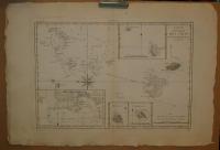 |
te1220. map/Australia, Oceanian put into the basket Bonne, Rigobert: Esquisse de la Baye Dusky, dans la Nouvelle Zeelande.Paris. ca. 1780. copper engraving.size: 22x33 cm. page: 31x44 cm. price: 33.8 EURO | 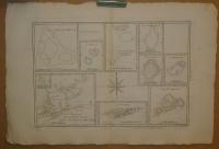 |
te1210. map/Australia, Oceanian put into the basket Bonne, Rigobert: Carte des Isles de la Societé.Paris. ca. 1780. copper engraving.size: 22x33 cm. page: 31x44 cm. price: 67.61 EUROFrancia Polinézia. Társaság szigetek. | 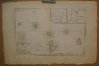 |
te1205. map/Australia, Oceanian put into the basket Bonne, Rigobert: Isles des Nouvelles Hébrides, et celle de la Nouvelle Calédonie. ( France , Vanuatu ).Paris. ca.1780. copper engraving.size: 22x33 cm. page: 32x46 cm. price: 42.25 EURO | 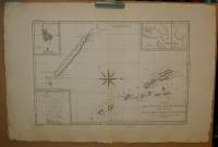 |
te1211. map/America put into the basket Bonne, Rigobert: Les Petites Antilles ou Les Isles Du Vent, avec Celles de Sous Le Vent.Paris. ca. 1780. copper engraving.size: 22x33 cm. page: 31x44 cm. price: 78.87 EURO | 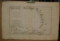 |
te1212. map/America put into the basket Bonne, Rigobert: Carte de l'Entrée de Norton et du Détroit de Bhering où l'on voit le Cap le plus oriental de l'Asie et la pointe la plus occidentale de l'Amerique. ( Bering szoros ).Paris. ca. 1780. copper engraving.size: 22x33 cm. page: 31x44 cm. price: 67.61 EUROAsia, America. | 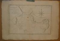 |
te1208. map/America put into the basket Bonne, Rigobert: Isles de la Reine Charlotte.Paris. ca.1780. copper engraving.size: 22x33 cm. page: 32x46 cm. price: 33.8 EURO | 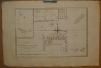 |
te1204. map/Australia, Oceanian put into the basket Bonne, Rigobert: Carte du Gouvernement de Bretagne. Assujettie au ciel et projettee.Paris. ca.1780. copper engraving.size: 22x33 cm. page: 32x46 cm. price: 33.8 EUROPapua New Guinea. | 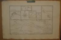 |
te1219. map/Canada put into the basket Bonne, Rigobert: Isle et Banc de Terre-Neuve, Isle Royale et Isle St. Jean; avec l'Acadie ou la Nouvelle Ecosse.Paris. ca. 1780. copper engraving.size: 22x33 cm. page: 31x44 cm. price: 101.41 EURO | 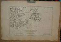 |
te1222. map/Australia, Oceanian put into the basket Bonne, Rigobert: Galles Meridle. ou Cote Orientale de la Nouvelle Hollande.Paris. ca. 1780. copper engraving.size: 22x33 cm. page: 31x44 cm. price: 67.61 EURO | 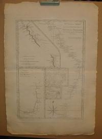 |
te1225. map/Africa put into the basket Bonne, Rigobert: Le Royaume D'Adel: Les Cotes D'Ajan et de Zanguebar.Paris. ca. 1780. copper engraving.size: 22x33 cm. page: 31x44 cm. price: 50.7 EURO | 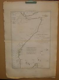 |
te1231. map/America put into the basket Bonne, Rigobert: Isles de St. Domingue et celle de Porto Rico.Paris. ca. 1780. copper engraving.size: 22x33 cm. page: 31x44 cm. price: 101.41 EURODominica, Puerto Rico. | 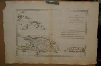 |
te1202. map/America put into the basket Bonne, Rigobert: Nouveau Royaume de GRENADE, Nouvelle ANDALOUSIE et GUYANE.Paris. ca. 1780. copper engraving.size: 22x33 cm. page: 31x46 cm. price: 50.7 EURO | 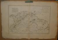 |
te1226. map/America put into the basket Bonne, Rigobert: Pérou et Pays Circonvoisins.Paris. ca. 1780. copper engraving.size: 22x33 cm. page: 31x44 cm. price: 67.61 EURORepública del Perú. | 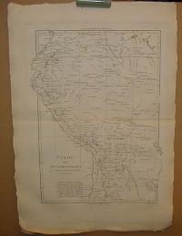 |
te1227. map/America put into the basket Bonne, Rigobert: Bresil et Pays Des Amazones, avec Le Gouvernement De Buenos-Ayres I-II.Paris. ca. 1780. copper engraving.size: 22x33 cm. page: 31x44 cm. price: 70.42 EUROBrasilia. | 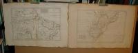 |
te170. map/America put into the basket Bonne, Rigobert: LES ISLES ANTILLES, ET LE GOLFE DU MÉXIQUE.Paris. 1787. copper engraving.size: 21x32 cm. page: 26x38 cm. in green paspartu. intact margin. price: 101.41 EUROJó állapotú. Good condotion.
A jobb felső sarokban a Bermudák. | 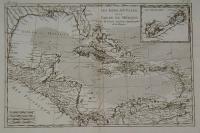 |
te173. map/America put into the basket Bonne, Rigobert: PARTIE MÉRIDIONALE, DE L'ANCIEN MÉXIQUE ( Mexico).Paris. 1787. copper engraving.size: 21x32 cm. page: 26x39 cm. in green paspartu. intact margin. price: 101.41 EUROJó állapotú. Good condition. | 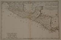 |
te299. map/America put into the basket Bonne, Rigobert: La Guyane Francoise, avec partie de la Guyane Hollandoise: suivant les Opérations et les Cartes récentes des Ingénieurs-Géographes Francois (South America).Paris. 1787. copper engraving.size: 32x21 cm. page: 40x26 cm. price: 33.8 EURO | 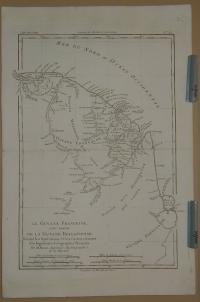 |
te175. map/America put into the basket Bonne, Rigobert: AMÉRIQUE MÉRIDIONALE ( South America).Paris. 1787. copper engraving.size: 32x21 cm. page: 39x26 cm. in green paspartu. minimaly stained outside the picture. price: 78.87 EURO | 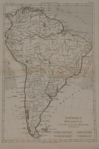 |
te1216. map/America put into the basket Bonne, Rigobert: Cartes de Supplément Pour les Isles Antilles.Paris. ca. 1780. copper engraving.size: 22x33 cm. page: 31x44 cm. price: 70.42 EURO | 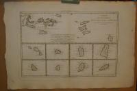 |
te1215. map/America put into the basket Bonne, Rigobert: Isles Maidenland, de Hawkins, et le Detroit de Fakland.Paris. ca. 1780. copper engraving.size: 22x33 cm. page: 31x44 cm. price: 33.8 EUROFalklans szigetek. | 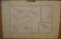 |
te1206. map/Asia put into the basket Bonne, Rigobert: Terre De Kerguelen, Appellee par M. Cook, Isle De La Desolation.Paris. ca.1780. copper engraving.size: 22x33 cm. page: 32x46 cm. price: 33.8 EURO | 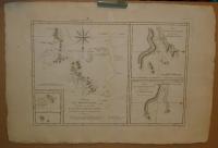 |
te1443. map/Asia put into the basket Bonne, Rigobert: Tartarie Chinoise, Roy. de Corée et Isles du Japon.Paris. 1787. copper engraving.size: 22x33 cm. page: 31x44 cm. price: 101.41 EURO | 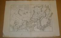 |
te1444. map/Asia put into the basket Bonne: L'Asie.Paris. 1780. copper engraving.size: 21x30 cm. page: 26x39 cm. price: 50.7 EURO | 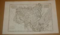 |
te336. map/Indinesia put into the basket Fremin: Skizzirte charte von der Insel Celebes.Prag. 1812. copper engraving.size: 27x18 cm. page: 32x20 cm. price: 25.35 EURO | 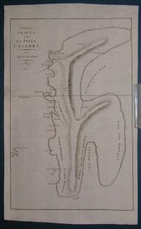 |
te283. map/France put into the basket Merian, Matthäus: Lotharingia ducatus; Vúlgo Lorraine.Frankfurt. 1695. copper engraving.size: 28x36 cm. page: 32x37 cm. price: 50.7 EURO | 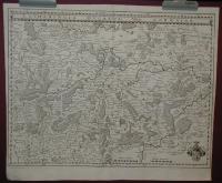 |
te1434. map/China put into the basket Bonne, Rigobert: Empire de la Chine Rme de Corée et Isles du Japon.Paris. 1787. copper engraving.size: 22x34 cm. page: 31x44 cm. price: 101.41 EUROKorea
Japan. | 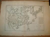 |
te172. map/World put into the basket Bonne, Rigobert: PLANISPHERE SUIVANT LA PROJECTION DE MERCATOR.Paris. 1787. copper engraving.size: 21x32 cm. page: 26x38 cm. in green paspartu. intact margin. price: 70.42 EUROJó állapotú. Good condition. | 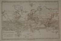 |
te284. map/France put into the basket Merian, Matthäus: Sabaudia Ducatus Savoye.Frankfurt. 1695. copper engraving.size: 27x36 cm. page: 32x37 cm. stained. price: 50.7 EURO | 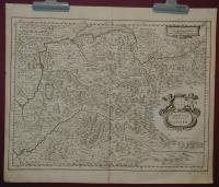 |
te285. map/France put into the basket Merian, Matthäus: Utriusque Burgundiae, tum Ducatus tum Comitatus Descriptio.Frankfurt. 1695. copper engraving.size: 27x36 cm. page: 32x37 cm. stained. price: 50.7 EURO | 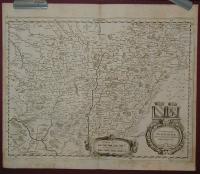 |
te800. map/Israel, Palestine, Judaica put into the basket Lapie: Carte de la Syrie et de L'Egypte anciennes.Paris. 1851. copper engraving.size: 53x37 cm. page: 66x50 cm. intact margin. price: 84.51 EURO | 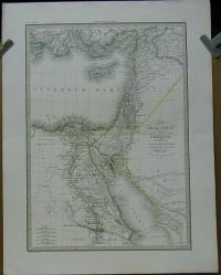 |
te153. map/Canada put into the basket Bonne, Rigobert: L'Isle de Terre-Neuve, L'Acadie, ou la Nouvelle Ecosse, L'Isle de St Jean et la Partie Orientale du Canada.Paris. 1780. copper engraving.size: 21x32 cm. page: 26x38 cm. in green paspartu. intact margin. price: 101.41 EURO | 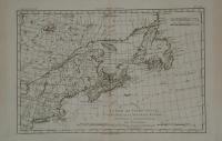 |
te292. map/America put into the basket Bonne, Rigobert: Carte de l'Isle de St. Dominigue (Dominique) une des Grandes Antilles, Colonie Francoise et Espagnole.Paris. 1787. copper engraving.size: 21x32 cm. page: 26x40 cm. minimaly stained. price: 101.41 EURO | 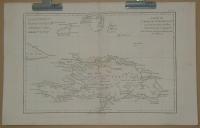 |
te993. map/Hungarian county map put into the basket Gönczy Pál: Modrus-Fiume vármegye térképe.Budapest. 1894. .size: 24x30 cm. price: 3.38 EUROGönczy Pál (Hajdúszoboszló, 1817. dec. 26. – Karácsond, 1892. jan. 10.):
pedagógus, az MTA l. tagja (1858). 1834-től a debreceni kollégiumban bölcsészetet tanult, 1838-tól tanító, ill.... | 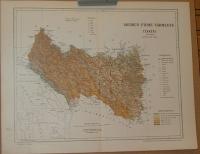 |
te978. map/Hungarian county map put into the basket Gönczy Pál: Alsó-Fehér vármegye térképe.Budapest. 1894. .size: 24x30 cm. price: 3.38 EUROGönczy Pál (Hajdúszoboszló, 1817. dec. 26. – Karácsond, 1892. jan. 10.):
pedagógus, az MTA l. tagja (1858). 1834-től a debreceni kollégiumban bölcsészetet tanult, 1838-tól tanító, ill.... | 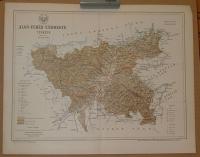 |
te493. map/Hungarian county map put into the basket Gönczy Pál: Torda-Aranyos vármegye térképe.Budapest. ca 1900. .size: 20x27 cm. page: 24x30 cm. price: 3.38 EURO | 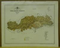 |
te973. map/Hungarian county map put into the basket Gönczy Pál: Beszterce-Naszód vármegye térképe.Budapest. 1894. .size: 24x30 cm. price: 3.38 EUROGönczy Pál (Hajdúszoboszló, 1817. dec. 26. – Karácsond, 1892. jan. 10.):
pedagógus, az MTA l. tagja (1858). 1834-től a debreceni kollégiumban bölcsészetet tanult, 1838-tól tanító, ill.... | 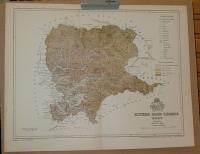 |
te492. map/Hungarian county map put into the basket Gönczy Pál: Szilágy vármegye térképe.Budapest. ca 1900. .size: 20x27 cm. page: 24x30 cm. price: 5.07 EURO | 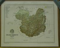 |
te1021. map/Hungarian county map put into the basket Gönczy Pál: Krassó-Szörény vármegye térképe. Comitatul Caraș-Severin, Romania.Budapest. 1894. .size: 30x24 cm. price: 3.38 EUROGönczy Pál (Hajdúszoboszló, 1817. dec. 26. – Karácsond, 1892. jan. 10.):
pedagógus, az MTA l. tagja (1858). 1834-től a debreceni kollégiumban bölcsészetet tanult, 1838-tól tanító, ill.... | 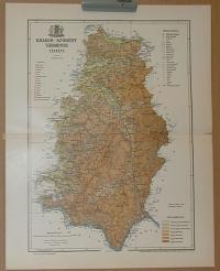 |
